
Here in the North-Central Sierra Nevada we’ve all been longing for cleaner air, cooler weather, more water in the streams, greener vegetation and less fire danger. That time has arrived – it’s called winter, and it’s best enjoyed by participating in it. Winter is another superb season for hiking in the Yuba-Bear watersheds.
“There’s no such thing as bad weather, only unsuitable clothing” – You’ve probably seen this well-worn outdoorsy quote many times. It’s usually attributed to Alfred Wainwright, who wrote hiking guidebooks in the British Isles. First off, this is an untrue comment and dangerously simplistic. While I get the Be Bold attitude it still sounds as if it was written by a marketer of outdoor clothing. What’s irresponsible is suggesting that nature is a mere nuisance and not a formidable and often unpredictable force capable of creating weather ranging from merely “inconvenient” to devastating disasters. Being respectful and aware of the landscape you’re navigating (and dressing sensibly) will provide you the greatest satisfaction and the most safety.
Fortunately, among my friends, there is a small band of rugged and enthusiastic hikers who are willing to undergo some rough weather for exercise and cheap thrills. But, truthfully, I have had a difficult time getting people enthusiastic about hiking in the wind, rain and snow. Actually, most winter days around here are sunny, bright and crisp with a blue sky that is unattainable in the summer, while on other days skies are in shades of gray, but seldom depressing. In the winter, I’ve found that it’s often more pleasant outside than it appears from the inside. The sun may, or may not, “break-through”, but once you’re outside it’s great to be out, regardless.
In general, winter hiking takes longer than summer hiking – you tend to move slower and encounter more obstacles – plan accordingly. Days are shorter in winter, so hit the trail early to avoid being out in the dark and always bring a flashlight or headlamp (spare batteries too). Contact land managers, etc. to inquire about conditions and high-risk areas. If you’re in a group, base the plan on the least experienced/able person. Always tell someone your plan – where you’re headed (include a map), your estimated return time, who you’ll be with, etc. When in doubt, don’t go out.
Inclement weather, however, you define it, provides drama and often interesting photos. If possible, test your raingear, wind breaker or lug-soled shoes before you’re in a circumstance where you need to depend on them.
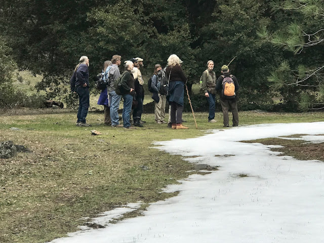
 |
| Winter on the South Yuba, near Purdon Crossing about 1986 |
GENERAL RECOMMENDATIONS:
Wear a hat, the value of a wool hat and scarf can’t be overemphasized – about 4 % of body heat is lost through the head, neck and shoulders. Pack gloves, dry socks and bring enough food and water. Hiking poles absorb shock on descents and provide stability on slippery surfaces.
Technological devices can malfunction in cold temperatures or when wet, so bring extra batteries/battery packs. Don’t rely on your phone. A few years back, in September, we were up near Gold Lake/Sierra Buttes when we were surprised by a summer squall with heavy rain. Suddenly everyone was scrambling to get their cell phones deep inside their packs where the rain couldn’t reach them. Still another use for the versatile Ziploc baggie.
I also carry a topographic map, a whistle, a pocket-knife, a compass, a small first aid kit, plastic bags for wet clothing or garbage, toilet paper, sun block or sunscreen, packets of trace minerals and a lighter. I always carry a bandana as well because they come in handy. They make a decent sling or bandage and they’re good for wrapping treasures like that bird wing or fox skull that you need to take home. Be aware. It only takes a light dusting of snow to obscure trail splits and turns. If you’re not sure of your location in a particular situation, you’ll be glad that you have GPS and/or a topo map with you.
Food is fuel – bring enough. Just as a wood stove requires logs to create warmth so does your body need calories to generate warmth and energy. Bring more of the various energy bars, nuts, and cookies than you think you’ll need and share them.
One more thing. Some trails because of their slope, soil, or use patterns can take a beating in the wet season and suffer erosion, landslides, etc. If you see a trail that’s being overused or has been damaged please stop using it, advise your friends to stay off of it, and report the damage to the agency managing the trail.
 |
| Near Maybert, on the South Yuba above Washington |
Dress for the known weather conditions but be prepared for the unknown. Each layer has a different function in the creation of a microclimate around your body. When hiking in cold weather, you should wear three layers. If you get hot, shed a layer before you get too sweaty.
The inner, or base, layer is meant to transport body moisture away from the skin so that wet undergarments do not rob the body of heat. Polypropylene, silk, wool or cotton-net undergarments are recommended. A middle layer allows for insulation against cold air. This would include such items as a long-sleeved shirt, a wool sweater, a vest or a jacket. The outer layer is meant for protection in case of adverse conditions like snow, rain and high winds. Typical outer, or shell garments, are Goretex jackets, windbreakers, coated nylon shells or waterproof parkas.
Avoid sweating to the point that your clothing gets wet. Most outer garments have features to allow for the escape of heat. Of course, you can always open your parka or even remove a layer of insulation. Naturally you heat up when you’re moving but when you stop for a break, put something on. Dress before you start to get cold. Anticipate your metabolism slowing down and keep a warm body core by putting something on.
Wool has the miraculous ability to retain heat and warmth even when it’s soaking wet. The investment you make in a good wool sweater, jacket or hat is worth it because it’s going to protect you. Leave extra clothing in your vehicle for when you get back – dry clothes are always welcome.
 |
| Chilly, but cool. |
COLD
Hypothermia. Be aware of it because it can sneak up on you and take your life! When you begin to lose heat faster than your body produces it, the process begins. Wet clothing facilitates the progression. If exposure continues until your energy reserves are exhausted, cold eventually reaches your brain, depriving you of judgment and reasoning power. You will not be aware this is happening.
The symptoms of hypothermia include uncontrollable fits of shivering, slow and slurred speech, memory lapses, incoherence, immobile and fumbling hands, a stumbling and/or lurching gait and drowsiness. The desire to lie down and close your eyes is nearly impossible to fight off, but it is crucial to remain awake. A victim of hypothermia will lie down to rest, fall asleep, lose more body heat and die. I have had several close calls with hypothermia that have made me very respectful.
Many years ago, after spending a few days alone on the Pacific Crest Trail near Gold Lake, I was surprised by an early snowfall. It was wet and slushy snow, so I started downslope toward my car, which was a few hours away. As I descended there was more rain than snow, and by the time I got close to Gold Lake, I was soaked, and a bit confused about where my car was parked. I was really getting tired and despite the fact that I was only about a half-mile from the car, I thought that it might be a good idea to lie down for a rest. My thinking was very fuzzy at this point, but luckily, I stumbled upon a summer camp with wooden buildings that was closed for the winter. One of the buildings was open, so I went inside and immediately wanted to lie down for a nap on the bunk, despite my wet clothing, which by now had me shivering. There was a small voice telling me to get out of my wet clothes and into my sleeping bag, but it was not as persistent as the big voice telling me to get some sleep right now. Somehow, I did get out of my clothes and into my dry down bag. I’m lucky to be here. This was stupid behavior that could have been prevented. Right up front I should have been with a companion who could have noticed my symptoms. Secondly, where was my rain gear? Clearly, I was unprepared to begin with, and the hypothermia only made me more stupid.
If the weather is cold (but not necessarily freezing) and you get wet from rain, melting snow or perspiration; and if the wind then picks up to increase the chilling effect, you are a prime candidate for hypothermia. Cold is not necessarily a factor –I have seen the temperature drop after a downpour followed by strong wind in July. Remember, hypothermia has to do with your body’s ability to retain heat. Wind and rain can cause heat loss at any time of the year. When you stop for a break, put a layer of clothing on before you cool down, and don’t sit on a cold rock surface where you can lose heat by conduction; sit on your pack or on a log.
First aid for hypothermia involves getting the victim out of the cold and or wind. Get them out of wet clothing, cover with blankets and offer warm beverages. If the person is not breathing begin CPR.
Frostbite. Frostbite is less likely because it’s caused by exposure to very cold temperatures, whereas most hiking occurs during warmer weather or at lower elevations. However, because spring and fall weather is so unpredictable, it can’t hurt to be prepared. Frostbite is caused when crystals form superficially or in the underlying tissue of the skin and in the body fluids. The extremities—the nose, ears, fingers and toes are most commonly affected. The effects of frostbite are more severe if the body parts are thawed and subsequently refrozen.
Symptoms of developing frostbite include skin with a glossy sheen, skin color changing to white or grayish-yellow and numbness and blisters that may appear in the affected tissue. Frequently victims will not be aware of frostbite until someone else notices their pale, glossy skin. First aid is to warm the affected area(s) rapidly (but without rubbing or disturbing the frozen tissue, which could lead to gangrene). Out on a hike the best you’ll be able to do is cover the affected area, get back to your vehicle and out of the weather as soon as possible. Seek medical attention immediately.
 |
| That's me in 1978 out for a few days of spring skiing near Castle Peaks |
Most people who hike in winter do so just below the snow line in the mixed conifer forests and on stream-lined trails where there is plenty of moss, lichen and other spore bearing plants. These lush, bold green plants can dominate and dazzle a landscape in the winter so treat yourself to this seasonal splendor. If you want to know more about these plants, I recommend Katie O’Hara’s North Yuba Naturalist blog and these two posts in particular:
https://northyubanaturalist.blogspot.com/search?q=Moss+in+Winter
Enjoy, but Leave No Trace
 |
| In the 1980s I had a cabin on Washington Ridge at about 4,500' . It was colder then. |
/\/\/\
If you live in the vicinity of the Bear or Yuba watershed here are a few places to hike in the winter – I’m only offering general locales here. Details about these hikes are available from various sources online.
The Spenceville Wildlife Area contains 11,900 acres of wildlife habitat in the Bear River watershed. There are many trails, averaging 3 to 6 miles long with little climbing involved. Most of the area is in a savannah-type setting, featuring blue oak and gray pine. Elevations range between 200 to 1,200 feet. Its major perennial stream is Dry Creek. The trail to Fairy Falls has become a popular attraction and for that reason is best enjoyed in “bad weather.” https://wildlife.ca.gov/Lands/Places-to-Visit/Spenceville-WA
 |
| Fairy Falls on Dry Creek, near Spenceville. It's raining. |
Also, in the Bear River basin is the Empire Mine State Historic Park in Grass Valley and its system of trails https://www.parks.ca.gov/?page_id=499
Bridgeport is a former settlement, mining locale and historic resort with a historically significant covered bridge situated on the South Yuba River. I lived here in a tipi, with my family, in 1973. It’s now a park managed by the California State Parks system. The two main trails are Buttermilk Bend, a beautiful 2.2-mile roundtrip, very popular and very easy, and the Point Defiance Loop Trail, which is If you live in the vicinity of the Bear or Yuba watershed here are a few places to hike in the winter – I’m only offering general locales here. Details about these hikes are available from various sources online.
Also in the Bear River Basin is the Empire Mine SHP in Grass Valley and its system of trails https://www.parks.ca.gov/?page_id=499
The Black Swan Preserve is located near Smartsville where elevations range from 750 to 900 feet https://www.bylt.org/trail/black-swan-trail/. Currently there is a 2-mile loop trail around a former hydraulic mining excavation that is now a pond and wildlife preserve. Views are impressive. There is also a side trip to a scenic section of Deer Creek and more options will be added in the future.
Bridgeport is a former settlement, mining locale and historic resort with a historically significant covered bridge situated on the South Yuba River. I lived here in a tipi, with my family, in 1973. It’s now a park managed by the California State Parks system. The two main trails are Buttermilk Bend, a beautiful 2.2-mile roundtrip, very popular and very easy, and the Point Defiance Loop Trail, which is 2.7-miles. In the summer this park is way too overcrowded for me, so I either start way early or wait for winter, when the weather is “uninviting.”
https://www.parks.ca.gov/?page_id=496.
Nevada City is a base camp for several decent trails just as was in the days before the gold rush when the indigenous Nisenan made it an important settlement and trade hub because of favorable topography and a variety of abundant ecosystems.
From downtown you can pick up the Deer Creek Tribute Trail and follow the combination of road and trail down Deer Creek to the extremely popular suspension bridge. This is as far as most people go, but if you follow the obvious trail markers downstream on Champion Road, then onto the Newtown Ditch, you can see the impressive China Bridge as well, located only 2.2 miles from Nevada City. By getting back on the ditch/trail you can continue following it downstream to Newtown Road, about 3-miles out. There is no shortage of information about this route. https://www.bylt.org/trail/deer-creek-tribute-trail-chinese-bridge/
Another trail beginning in Nevada City is the Hirschman Trail, which if you walk it all, is a 4.8-mile round trip. Here the landscape undulates amidst mixed conifers and oaks doing a good job of repopulating a heavily mined area.
https://www.bylt.org/trail/hirschman-trail/
There is another short trail currently in the process of realignment. It’s the called the Sugarloaf Trail. It’s named after a Nevada City geological landmark, a 3,060’ peak that offers a tremendous view of the town situated in the Deer Creek drainage. It’s been a favorite local vista for hundreds, if not thousands, of years. From the top, at a glance, it’s evident that we live in a forest and should behave accordingly. https://www.bylt.org/trail/sugarloaf-mountain-trail/.
Lately, the Old Downieville Highway from Nevada City has become popular as a trail, but you would be wise to remember that it’s a well-used paved road, so be careful here.
The Cascade Canal Trail, a few miles east of Nevada City, is part of a historic water conveyance system used for gold mining, electrical power generation, and irrigation. Ditches/canals are part of our legacy and they often make excellent trails. https://www.bylt.org/trail/cascade-canal-trail/
Round Mountain is a mixed conifer, black oak environment with elevations from 1,970’ to 3,250’. There is a limited but very good trail system here and it’s only four miles from Nevada City. https://www.blm.gov/visit/south-yuba-recreation-area
In the South Yuba canyon there are many options like the South Yuba Trail and the trail system at Malakoff Diggins State Park. The North Yuba River has the Canyon Creek Trail and the North Yuba Trail, both of which I enjoy most in the winter.
Realize that I’m only nibbling at the trail possibilities, there are many more.
• • •