Friday, December 28, 2018

THE SPENCEVILLE WILDLIFE AREA: ROLLING HILLS UNDER A BIG SKY


 The Spenceville Wildlife and Recreation Area (SWA) is the largest publicly owned tract of blue oak - gray pine woodland habitat in the North Central Sierra foothills.  It contains 11,942 acres, extending 10 miles from north to south and up to 4.5 miles east to west. Straddling the western boundary of Nevada County and the eastern boundary of Yuba County, the wildlife area is bordered on the west by Beale Air Force Base and on the north, south, and east by privately owned ranches and parcels.  The SWA is managed by the Department of Fish and Wildlife (formerly known as the Department of Fish and Game) and is located within the Dry Creek drainage, which joins the Bear River near Wheatland. There are numerous ponds, creeks, trails and riparian zones in the area.  Parts of Vineyard Creek, and most of Cox and Little Dry Creeks flow south through the area boundaries to join Dry Creek, a perennial stream.

THE ECOSYSTEM
The primary habitat is open savannah rising eastward to open woodlands with shrubby understories.  Lower elevation woodlands merge with annual grasslands.  Blue oak and gray pine are the characteristic species with sporadic valley oak and interior live oak.  Near the water courses and ponds there are willow, alder, cattails and other riparian species.

Blue Oak

Blue oak is California’s dominant oak species, representing more than one-third of the state’s oak woodlands. Blue oaks are adapted to drought and dry climates and they can survive temperatures above 100° F for several weeks at a time.  Average maximum temperatures in July can range from 70° to 100° F while annual precipitation averages 20 to 40 inches and mostly falls in the form of rain.

Blue oak acorns are long, thin, and gently tapering.  They are 3/4 to 1 1/2 inches long with shallow caps.  The acorns ripen in one year, and can germinate after one month, unlike other oak varieties, which germinate the following spring.  From the beginning most of the growth is in the roots instead of the shoots.  This allows it to tap into available water sources right away to survive dry conditions. It’s an important food source for deer, rodents, game birds and at least a dozen species of songbirds.  They are slow growers, and deceptively small plants can be 25 years old.  Blue oaks can live 200 to 500 years, but the blue oak population has decreased because there has been little natural regeneration.  According to Department of Fish and Wildlife (DFW) employees, grazing cattle and feral pigs eat many of the acorns and seedlings.

On the west slopes of the Sierra Nevada, blue oak is abundant in the foothills at an elevational range of 500 to 2,000 feet.  The most common tree associate of blue oak is gray pine however blue oak extends farther into valleys but not as far into montane regions as the pine.  Blue oak is usually the majority species, grey pine inevitably the taller.  Most sound acorns fall between mid-September and the end of October.  They average 100 seeds per pound and yield from 55 to 180 pounds. 

Acorn woodpeckers are very busy birds

Recently conducted wildlife surveys of SWA found 42 mammal species, 12 kinds of reptiles, 4 kinds of amphibians, and 20 fish species.  The Audubon Society considers Spenceville a birding “hot spot”, listing 80 nesting, and 175 migratory bird species.

CULTURAL CONTACT
There is no clear evidence that Spanish or Mexican land uses had any significant impact on the distribution or abundance of oak woodlands.  The introduction of livestock led to dramatic changes in understory species, which may have had some effect on oak regeneration, but this first wave of settlement left California’s oak woodlands largely intact.

Major changes began during the American period, with the huge population influx that accompanied the Gold Rush.  Within two decades, riparian oak woodlands were nearly completely destroyed.  Oaks were cleared for agriculture, fuel wood, charcoal, rangeland improvements, and urbanization. Recent urbanization has expanded into oak woodlands, fragmenting wildland habitat.

After 1940 agricultural land clearing was encouraged through federally funded programs. Examples include the War Food Program started in 1941, and the Agricultural Adjustment Administration range improvement program intended for the Eradication and Control of Destructive and Competitive Plants.  It was assumed that removal of blue oak would improve forage production, so inexpensive methods were devised for killing and removing oaks.  These methods included poisoning with herbicides such as 2,4-D and 2,4,5-T and burning and bulldozing.  I don’t know if any of these programs were implemented in the Spenceville area.  Another impact has been predator extermination, which has caused an increase in acorn and nut eating animals including gophers, mice, ground squirrels, rabbits, deer and cattle. Acorns and seedlings are being eaten out existence.

Winter is beautiful at Spenceville

In 2002 the U. S. Forest Service published research findings in Oaks 2040: The Status and Future of Oaks in California.  They estimate that of the 3 million acres of blue oaks in California 750,000 acres, or 25 percent of California oak woodlands, will be seriously threatened from a burgeoning state population by 2040.  Many species of oaks are under threat of extinction in the wild, largely due to land-use changes, livestock grazing and unsustainable harvesting.  

The Sacramento region, which includes the Yuba and Bear Rivers, is more at risk for development than any other.  Only two-thirds of the oak woodlands are considered “stable.”  More than 300,000 acres of oak woodland could be developed in the Sacramento region by 2040.  By 2040, 80 percent of El Dorado County’s oak woodlands and more than half of the oak woodlands in Nevada, Yuba, and Placer Counties may be developed.  They conclude that California should plan for protection of its stable oak ecosystems now,  before these ecosystems are fragmented beyond repair.  We are indeed very fortunate to have access to the Spenceville Wildlife Area – it has become an endangered ecosystem.  Meanwhile, in 2004, congress passed legislation designating the oak as America’s national tree.

THE NATIVE NISENAN PEOPLE 
The Spenceville area has a rich history that begins thousands of years before the Spanish, Mexicans and European gold seekers arrived.  Bedrock mortars for pounding acorns and other foods are plentiful especially near springs and streams and they are a visible legacy of the Nisenan people who have lived here for at least 1,500 years.  By the time of European contact, acorns and pine nuts were a major part of the Nisenan diet.  They manipulated the environment by frequently burning the landscape to improve the gathering of acorns, to facilitate collection of grass seeds, to stimulate growth of shoots used for basketry, to clear brush for hunting and to create nutritious browse for deer.  These deliberate fires helped maintain open oak savannas where succession would have led to coniferous forest.

The Nisenan interacted with the largest oaks and sustained an intimate relationship with them for centuries.  They were aware that they provided sustenance, shade and continuity for generations.  Ancient oaks were living monuments that witnessed the history of the indigenous people unfold.  Generations of Nisenan met in the shade and splendor of special oak trees.  To the colonizers, these gigantic oaks were viewed simply as trees without any inherent wisdom.  With the commoditization of oak trees, not only did their importance as food decrease, but their spiritual significance to the Nisenan diminished. 

Bedrock mortars on Dry Creek

Naturally, such reckless damage to the flourishing ecosystem that was their homeland was resented by the Nisenan.  The invaders ridiculed the natives, stole from them, abused the women and could be extremely violent.  When the Nisenan resisted, the foreigners formed militias and declared war on the natives – their paranoia and hatred was so intense that they petitioned for, and received, a small military garrison called Camp Far West, located a few miles southwest of SWA.

In 1850 the Camp Union Treaty was negotiated with the Nisenan, who by now realized that they were hopelessly outnumbered.  This was one of 18 treaties made with California Indians – not one of these treaties was ever ratified (but this is a story for another time).  The proposed reservation for the Nisenan included the current SWA.

A diseƱo, or map, of John Rose's Mexican Land Grant

In addition to the notorious impacts of gold mining there was grazing.  Before the gold rush John Rose was awarded a Mexican Land Grant known as “Rancho de Yubu” which was approximately 16 square miles and included parts of the SWA.  Rose became rich by providing the expanding mining population with cattle and horses fed on grasslands that once belonged to the Nisenan.

Agriculture was not sophisticated, nor was the palate of the average miner, but one endeavor requires special mention.  Scurvy was a problem because of a lack of Vitamin C.  A few innovative black men filled a need when, in 1852, they planted and sold cabbages, which stored well and provided vitamin C for would-be miners packing into the mountains.  The community of Cabbage Patch was just south of Dry Creek and along the busy road from Sacramento to Empire Ranch, a major transportation hub.  It was near the present-day Waldo Bridge and within the SWA. In 1898, when there was enough of a community to warrant a Post Office, Cabbage Patch was renamed Waldo, after Captain William Waldo, who in 1850 led a successful rescue party to the Humboldt Sink in Nevada.  

Cattlemen moving their cows

The Waldo schoolhouse was at the intersection of the Spenceville Road and Long Ravine Road and the current Waldo Bridge on Dry Creek was built in 1901.  Apparently, the bridge was rebuilt several times and almost destroyed by vandalism in 1964.  Now I don’t want to imply that this is a bad neighborhood but only last week my truck was broken into and robbed while parked alongside the road less than a mile from here.  Employees of SWA told me it’s happened before – so when you visit this otherwise beautiful place make sure that you don’t leave anything of value in sight.

Spenceville was named for Edward F. Spence, a Nevada City druggist, who in 1868 donated lumber to build the local school house.  Spence was a member of the Nevada City Board of Trustees in 1865 and later organized banks in several California cities.  He eventually served a term as Mayor of Los Angeles where he was instrumental in establishing the Mt. Wilson observatory.

Tailings in Albion Ravine

There is evidence of early gold mining in Albion Ravine and there was a copper boom along Little Dry Creek in the 1860s.  The most famous of the copper mines was adjacent to the town of Spenceville.  By 1879 the town of Spenceville had a Post Office, a school, three general stores and was home to 67 families.  In 1915 the mine’s surface structures burned to the ground.  Some of the families stayed and operated ranches

SPENCEVILLE MINE HISTORY
The mine was originally discovered by some men digging a well in 1862 who named it the Well Lead Copper mine.  In the 1870s the Well Lead and the adjoining Grass Valley Copper Mine were bought by the San Francisco Mining Company and $15,000 was invested on improvements to the site.  The combined mines were then renamed the San Francisco Copper Mine and Reduction Works. In 1880 their headframe collapsed into the shaft.  No one was injured but high expenses were incurred.  As a result, management abandoned shafts and decided on an open cut that measured 300’ long by 70’ wide by 75’ deep.  In 1882 they owned 43 acres of copper-bearing ground and 100 acres of adjoining land was bought for timber and fuel wood.  They were heap roasting ore that was hand-broken by Chinese workmen into small lumps before being hoisted to the surface where they were heap roasted.  The imperfectly roasted ore was then returned to a fresh roast-heap, and the rest trammed to the leach vats.  They employed 23 white men and 40 Chinese at the mine and the mill and several “wood choppers.”

With copper values in flux the San Francisco Copper Mine and Reduction Works sold their property to the Imperial Paint Company and Copper Works. The new owners didn’t really mine but instead reworked tailings containing iron oxides to produce a Venetian red paint pigment.  This paint became all the rage – it even won a Gold Medal in the San Francisco 1894 Winter Exposition.  But, by 1897 the business failed when it was discovered that the paint corroded the structural nails causing barns and other buildings to collapse.  Then the mine was renamed the Spenceville Mineral Company and in 1915 was damaged by a fire with mining completely shut down in 1918.

This is not the end of the story.  When I started visiting SWA in the late 70s the mining site was easily accessible with a pit containing deep blue water of a scary hue, nearby Little Dry Creek had strange chemical crusts on its banks, there was little vegetation and the soil was reddish, arid and dusty.  Not at all hospitable, not even natural.  Here’s the State Department of Conservation’s initial assessment of the situation: “The 10-acre site included 60,000 cubic yards of mine waste and a half-acre, water-filled mine pit.  The pit contained 7.5 million gallons of pH 2.5 acid mine drainage – essentially, battery acid that was trickling into two creeks.  The flooded pit posed a risk not only to wildlife, but also to people recreating in the area.”

In 1988 the Department of Fish and Wildlife started exploring the possibility of cleaning up the site, however funding to actually complete the project didn’t become available until 2000.  Actual work began in 2001 and was declared a success in 2013.  The former mine is currently fenced off while the replanted vegetation takes hold.  The pit has been drained and backfilled, the tailings removed, soil has been buffered by lime to remove its acidity and Little Dry Creek is replanted.  The Department of Conservation is pleased with the results and was honored with a Governor’s Environmental and Economic Leadership Award in 2013.

View from a bunker created when Beale owned this land

BEALE AIR FORCE BASE
In 1942 the U.S. Army acquired (often by eminent domain) 86,000 acres of oak-woodland and prairie grassland, including Spenceville, for training purposes.  There are still concrete bunkers from this era dotting the landscape within the SWA. By 1964 the government sold all but 22,944 acres, which it retained as Beale Air Force base.

SPENCEVILLE WILDLIFE AREA
The Department of Fish and Game acquired land from the federal government to create the Spenceville Wildlife Area in 1966.  Humans frequent the area as well.  There is a varied group of users that includes hikers, bicyclists, equestrians, bird watchers, fisherman, hunters and cattle ranchers who have grazing allotments here. They even offer a shooting range.

Map of the Spenceville area
Courtesy of Friends of Spenceville

TRAILS
Spenceville contains several very scenic trails that require little effort.  For instance, North Pittman Road is one of several closed roads with numerous equestrian trails that branch off revealing oak groves, open meadows and wildlife ponds.  To reach the road walk across the concrete bridge at the Spenceville parking lot and turn left.

The most popular hike is the well-marked 2.5-mile trail to Fairy Falls.  On a spring or summer weekend it can be extremely popular.  From the parking area walk across the concrete bridges over Dry Creek and Little Dry Creek and continue northeastwardly on the historic Spenceville Road as it gradually climbs.  The meadow on the north side of the road was the location of the town of Spenceville.  All that remains are some rock alignments, olive trees and a small concrete structure that was a well.  This segment of road/trail is about one mile long with an elevation gain of only 200 feet.

Fairy Falls on Dry Creek

When you come to the southern end of a beautiful valley the clearly marked trail leaves the road and extends southward.  In the 1860s this was the location of Zinc House, a way station where travelers could get food and water for themselves and their animals.  Soon the trail splits into an upper and lower trail to the falls.  The upper trail travels mid-slope though a savannah-like landscape of blue oak, grasses and wildflowers (in season) with a good overview of the Dry Creek canyon.  The lower trail is adjacent to the creek where there is different vegetation and access to water.  Early one April morning, while hiking the lower trail, I startled three deer and saw a display of hundreds of dewy fairy lanterns and yellow pretty faces illuminated by the rising sun.  For the full experience take the upper trail to the falls and return by the lower trail.

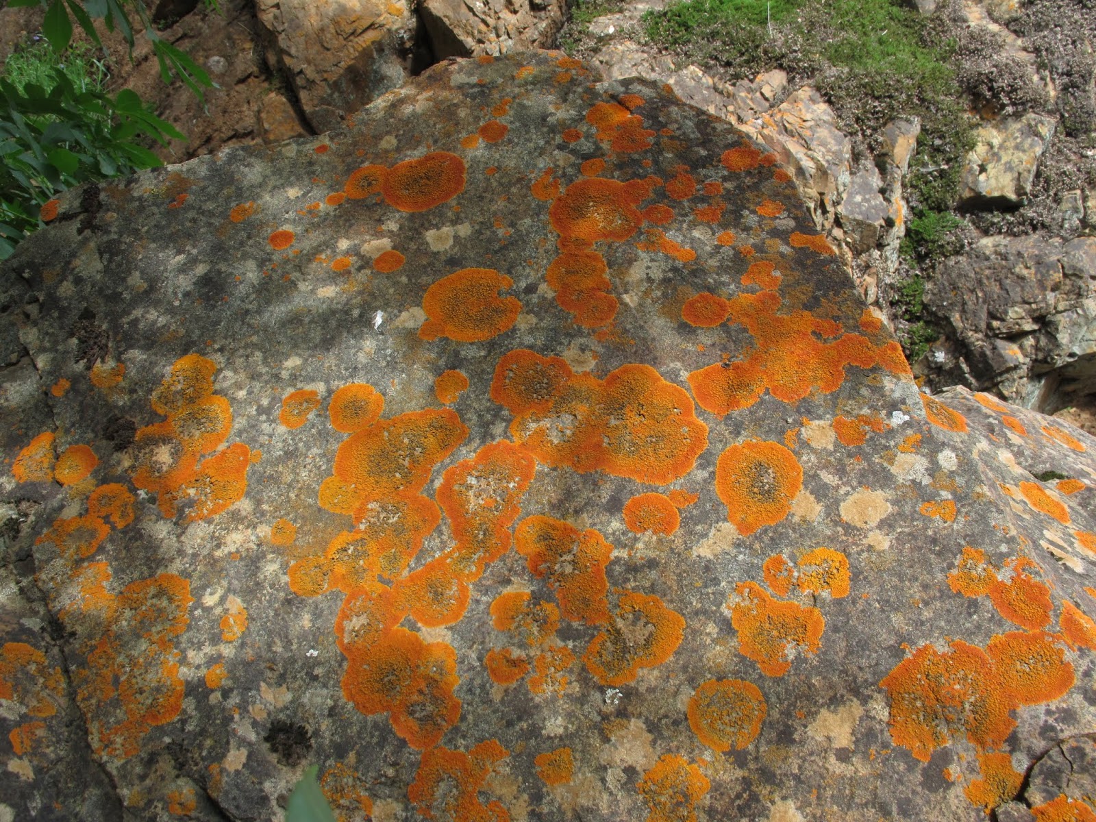
Luscious lichen at Fairy Falls

You'll be glad you made the effort.  At Fairy Falls, Dry Creek drops 40 feet before crashing into a dramatic bowl-shaped pool with steep walls surrounding it.  Below this pool is another, slightly smaller waterfall.  The view from the top of the falls is terrific.

SAFETY
Hiking is great all year at Spenceville, especially if you are prepared. Summers are very hot so bring enough water and protection from the sun and heat.  Poison oak thrives here but can be avoided by staying on roads and trails.  Learn to identify it.  Ticks are especially active in the spring and early summer.  In the winter Spenceville can be foggy creating a moody and mystic landscape that is damp and sometimes cold.  If you are coming to Spenceville from upslope you may be surprised to find yourself in valley fog, which is no problem if you remembered to bring appropriate clothing.


Remnants of the original Kneebone Ranch

HOW TO GET THERE: 
From Grass Valley, drive 12.5 miles west on Highway 20 toward Marysville.  Turn south (left) from Highway 20, at the Beale Air Force Base sign, onto the Smartsville-Hammonton Road.  After .9 mile, take the left fork on Chuck Yeager Road and continue for 3.8 miles to Waldo Road.  Continue along Waldo Road for 1.8 miles to the Waldo Bridge.  After crossing the bridge, continue to the left along Spenceville Road for 2.3 miles until you arrive at a parking area and trailhead by the old concrete bridge and abandoned mine site.

For maps and more specific information:

      Spring is gorgeous here 


Thursday, December 6, 2018

ARRIEROS, EXPRESSMEN & TEAMSTERS

Freighters at Cisco on the South Yuba
Photograph by Alfred Hart

There is only so much a man, or woman, even on a horse or mule, can carry.  Early in the gold rush most gold was found streamside on the Yuba, Feather and Bear Rivers but as the easy to find gold diminished the miners moved upslope, far from supply centers, to more remote upslope regions to find “the source.”  Once in the mountains they realized that gold was most profitably pursued in small groups, or “companies”, and that establishing a nearby camp with provisions was essential.

Supplies reached the mining camps on the backs of mules in pack trains managed by mostly Mexicans called arrieros.  Pack trains consisted of 40 to 50 mules each packing freight weighing 200 to 300 pounds a distance of 20 to 30 miles a day depending on terrain and climate.  In 1853 there were 31 packing companies operating from Marysville, including 20 owned by Mexicans.  At that time there were over 4,000 mules and 400 wagons based in Marysville.

Arrieros
Lithograph by Carl Carlos Nebel (1836)

An atajo was a caravan of pack mules and a jornado was a day’s march.  In a conversation with Gus Poggi, who packed freight to the mines north of Downieville in the 1930s, he said they still used the aparajo, a straw or hair-stuffed mattress that sits between the cargo and the mule. Some packers preferred the wooden crossbuck.

Among the earliest packers was Jesus Maria Bustillos, a LaPorte-based freight train packer with 125 pack mules, who eventually partnered with John Rossiter, adding another 75 mules to the team.  In 1860 Bustillos managed 140 mules and 40 drivers with an average pack train of 25 to 40 mules.  Jesus Bustillos died and was buried in LaPorte in 1913 at the age of 76.  There was a member of the Bustillos family consistently packing or freighting every year until 1918 when most freight hauling was motorized.

The Bustillos Family
Photographer and date unknown

In 1851 Frank Everts ran a pack train between Marysville and Gibsonville (the north-easternmost settlement in the Yuba River watershed).  His pack train traveled the ridge between Slate Creek and Canyon Creek passing through Scales and Mt. Pleasant, then up the Port Wine Ridge to Port Wine and the several small towns on the way to Howland Flat.  In the late 1850s Everts, Wilson and Company operated a daily Mountain Express between Marysville and all the mountain settlements of northern Sierra County and southern Plumas County.

The packing trade of Marysville was quite extensive serving Downieville, Eureka North, Morristown, St. Louis, Pine Grove, Poker Flat, Gibsonville, Nelson Point, American Valley, Indian Valley “and all intermediate and surrounding places in the counties of Sierra and Plumas", giving employment to about 2,500 mules, and between 300 and 400 men.  Hutchings' California Magazine (1856) reported, “On a single day 1000 pack mules left Marysville while carrying 100 tons of freight, or two steamboat loads.”  On April 19, 1862 a correspondent for the Sierra Democrat based in LaPorte, writes, “Considerable freight is now coming into this district on pack mules.  The tariff is still five cents per pound from Marysville to LaPorte.”

Mule loads included flour, beans, alcohol, molasses, canned goods, dried apples and medicines.  Bill Meek of Camptonville, who packed, freighted and drove a stage in eastern Yuba County and southern Sierra County, wrote in his memoirs:  “Many a barrel of good whiskey have I loaded on a mule, many a car load of powder, many tons of iron pipe monitors, organs, pianos, billiard tables, wood stoves, in fact everything that was used in mining camps.  Those were the good old days, 16 or 18 hours of labor, everybody happy and nobody idle.”


From Hutchings' California Magazine  

Mexican mules were favored over American because they were tougher and stronger.  They had been raised and trained in mountainous country, whereas most American mules had been used only for pulling wagons, farming and construction. In 1849 in Independence, Missouri a yoke of oxen cost $40 to $50 while mules cost $50 to $70 each.  Mules in California were valued at $50 to $150 and capable of carrying 250 to 300 pounds.  There are many stories that illustrate the toughness of Mexican mules, but it was still demanding and dangerous work.  In the winter of 1852-53 a pack train was snowed in, north of LaPorte, between Little Grass Valley and Onion Valley, where only 3 of 45 animals survived.

Expressmen specialized in the safe delivery of mail, packages and gold dust. The earliest expressmen were on foot and carried freight in backpacks.  Winter travel was far more difficult.  Once reaching the snow many packers and expressmen switched to skis or “snowshoes” as they were called then.  In the winter of 1857, J. B. Whiting initiated a Dog Express enterprise that worked pretty well for at least four winters.  Prior to that he ran a winter “man pack train” called the Feather River Express.  The Dog Express ran from the Buckeye Ranch in Yuba County to LaPorte then on to Quincy in Plumas County, a distance of about 30 miles.  The team consisted of four dogs harnessed to a sled – the preferred species was a cross between the Alpine spaniel, or “Bernadine”, and the Newfoundland dog.  It was a dependable service, carrying from 250 to 500 pounds of freight, “depending on the snow.”  When the snow was compact, the trip took about 10 hours.  Under ideal conditions they could even accommodate a passenger. 

From Hutchings' California Magazine

In 1862 there was a Pioneer Freight line operating in Sierra and Plumas Counties and by 1865 there was an express and passenger train operating three times a week between Downieville and Howland Flat via the trail through Deadwood and Poker Flat.  Even when snow made it impossible for pack trains the mail and a few light-weight items were delivered by men on snowshoes.  One of them was Granville Zacharian who had a snowshoe express between Downieville and La Porte that ran twice a week.  Also, during the mid 1860s, after much experimentation, horses were equipped with snowshoes.

Snowshoe for a horse
North Bloomfield  Museum

 The rugged ridges and valleys north of the North Yuba were dense forests with deep snow that I can’t imagine traveling in the winter.  In anticipation of isolating winters, citizens of remote mountain towns “laid in” huge quantities of flour, sugar, potatoes, onions, beets, carrots, apples, hams bacon, etc.
From Hutchings' California Magazine

As well-used trails became roads teamsters used freight wagons to get supplies as far as possible into the mountains where pack trains would meet them.  These places became supply centers and functioned as hubs for freight, mail, camaraderie and a connection to the outside world.  The Empire Ranch, near present-day Smartsville, was such a place and so was Depot Hill high on a ridge above the North Yuba below Indian Valley. Another was Illinoistown located between the Bear River and the North Fork of the American River, renamed Colfax when the transcontinental railroad was completed in 1869.

A wagon has obvious advantages over packing because there was no need for nightly unloading and a single freighter could carry 2,000 pounds.  On the other hand, a wagon couldn’t follow a contour without tipping – roads had to be built to accommodate them.  Early roads were seldom more than 6-8 wide.  The California freight wagon was flat-floored, 16 to 20 feet long and 3 or 4 feet wide. Loads were stacked as high as 15 feet with rear wheels often 6 feet in diameter with 4-inch wide iron tires.  A heavy-duty freighter with many mules could carry 6 to 8 tons.  An example was Andrew Kneebone of Spenceville who started freighting in 1880 – he used a team of 16 mules and horses to haul three wagons.  Roads eventually cross waterways so bridges, ferries or fords were also necessary and often collected tolls.

Freighters at Upper Cisco
Photograph by Alfred Hart

The Bridgeport covered bridge crosses the South Yuba on the Virginia Turnpike

The town of Cisco, on the South Yuba, was supplied by freight wagons using the Dutch Flat-Donner Pass Road and was totally dependent on the viability of the Meadow Lake Mining District, which boomed and busted between 1865 and 1867.  Meadow Lake was situated in rugged terrain and accessible only by trail.  Cisco had a population of about 1,000 including two hotels, the Cisco House and the Magnolia, three stores, two blacksmiths, a Post Office, a drug store and several saloons.  Charles Wooster, who lived nearby on the North Branch of the South Yuba (Fordyce Creek) in 1865 kept a journal: “This town was devoted mainly to the maintenance of mule team drivers and their animals, as well as road builders.  Saloon keepers were the most numerous class of businessmen.”  “Fifty mules in a line under one management was not uncommon.  A coffin containing a corpse would go by on a mule’s back, with the head of the corpse pounding audibly against the coffin in unison with the step of the mule.  A stamp shaft attached to the pack-saddle of two mules in single file supplied an interesting manifestation of a mule in military step.”

Downieville Packers
Photographer and date unknown

It hard to appreciate how important the mail was to lonely miners working hard in what they perceived as a remote and dangerous world.  Their original plans were to get rich and return home, very few, if any, planned to settle here so news from home was welcome and warming, sacred even.  When deep snow and harsh weather prevented mail delivery to the South Yuba town of Washington for several weeks, frustrated townspeople put up a $25 prize for whoever could deliver the mail from Nevada City.  Two young, but experienced, snowshoers were determined to get through and made it to within a half-mile of Washington when one of them, Malcom McLeod, succumbed to what was probably hypothermia.  Apparently, they had become “bewildered” while snowshoeing in the dark and were traveling in a circle (The Daily Transcript, January 7,1890).

I’m not going into stagecoaches here, because they, along with their infrastructure of roads and way-stations, are another story.  Most packers, expressmen, teamsters and drivers handled mixtures of freight and passengers.  By 1854 almost all stagecoach lines were owned by the California Stage Company, capitalized at $1 million.  The typical Concord Stage sat 9 to 12 people inside and up to 12 more on the flat roof.  They carried passengers and some freight.  Drivers, or “reignsmen” had more social graces and a much higher social standard than teamsters. They were often called “jehus” (a biblical chariot driver).  “The speed of Jehu” was a popular 19th century idiom. You won’t have to look hard to find information on stagecoaches, both technical and romanticized.


In the late 1970s there was a roadblock near Goodyears Bar on the North Yuba River that had drivers stopped on Highway 49 for a few hours and during that time I met a local “old guy” as I waited.  His stories were good.  He grew up in Brandy City and Indian Valley and saw the end of mining by the small mine operator and the post-World War II boom in lumbering.  The Cal-Ida mill employed nearly everybody.  He asked me if I knew where the Mountain House Road was and immediately, in my mind, I saw the steep and curvy descent from the ridgetop to Woodruff Creek and Goodyears Bar, and I said yes.  Then he told me that when he was a boy he often watched the stagecoach descend that road and thought that it was the most wonderful thing he had ever seen and he wanted to be a driver someday.  He said, “Imagine that – I’m (??) years old and I loved stagecoaches, and in my lifetime a man has landed on the moon – imagine that!”

In May of 1903, Dr. Jones of Grass Valley, was the first to drive his car into downtown Washington in order to treat a patient and by 1914 the automobile replaced the stage and freighters on the line between LaPorte and Oroville.  Within the next few years the freighting and passenger service business changed dramatically but packers continued to supply remote mines through the Depression years.


Photographer and date unknown


Friday, November 16, 2018

STACKED ROCK WALLS IN YUBA RIVER COUNTRY


Dry stacked rock walls from the historical era are commonplace in the Yuba watershed. They were used as retaining walls on pack trails, wagon roads, ditches and railroad grades.  Rock was also stacked to build foundations, cellars, dams, bridge abutments, races, sluices, walls, buildings, wells, culverts, fences, pens, chimneys, hearths and to create terraces for work, living and agricultural purposes.  Most walls were purely functional while others display serious craftsmanship.  There is no lack of rock in the Sierra Nevada.  The locations of boulders, field stones, exfoliating slopes, and concentrations of exposed rock were well known, but as a general rule projects were constructed with materials at hand.  A thorough look at the rich topic of rock work is beyond the scope of this humble post so I'll limit this commentary to some examples of dry stacked rock walls.

Tyler-Foote Crossing Road / Middle Yuba

TRAILS and ROADS
Trails or roads often required retaining or flanking walls on slopes to hold back erosion that could cover the tread from above or erode it from below.  For major projects like roads or ditches a crew was hired or assembled.  Generally, anyone with a strong back could find work. The Chinese often formed labor crews, especially after 1869 when the railroad was completed, but they were by no means the only nationality that built rock walls.  For instance, the impressive rock retaining walls on the road to Foote's Crossing of the Middle Yuba was built by crews of Italians and Slavs.

Bridgeport/ South Yuba

PASTURE WALLS
Most of these walls are found on foothill ranches with meadowland and nearby water.  Also called "tossed walls", they are common in Penn Valley, Spring Valley and the Spenceville Wildlife and Recreation Area as well as many other places. H. F French wrote a letter to The New England Farmer in October of 1855.  In it he said, "A stone wall is doubtless the cheapest and most durable of all fences, and where stones are constantly working up in your fields and must be removed, no doubt this is the best use to make of them", ... "our fields are cleared, and the boys have picked stones for a hundred years."  Naturally some of the walls followed recorded property lines.  This practice became commonplace when California became a State and surveying became more precise and important than it was in Alta California.

Stacked Rock Retaining Wall in Downieville/ North Yuba

Stacked Rock Retaining Wall in Nevada City/ Deer Creek

TERRACING
In the mountains, where there is little flat ground, it was essential to create terraces for buildings and machinery and to manage agricultural plots.  The gold rush brought Italians from Genoa, who came from the region of Liguria where there was a long tradition of stacked rock work and an estimated 25,000 miles of terraced hillsides.  They built many of the rock walls and terraces in the North Yuba Canyon near Downieville and Sierra City, among other places.

Stacked Rock Wall made with Quarried Rock/ Nevada City

Plug and Feather Method for Splitting Stone 

Quarrying a Bedrock Mortar Outcrop/ Sweetland/ Middle Yuba
 This is disrespectful to the indigenous Nisenan who were the original stone workers here. 

GRANITE BLOCKS/QUARRYING
Men from New England and the middle Atlantic states brought their own tradition of rockwork to the Yuba River region.  They had been quarrying and building with stone since the 17th century creating rectangular blocks of granite from rock outcroppings they called "surface ledges."  They used an ingenious but simple system for splitting rock in a straight line.

The plug and feather method to hew blocks of stone first appeared in late 18th century on the east coast and by the latter 19th century was widely used in the west.  The process involves drilling holes in a line, typically six or seven inches apart, then inserting feathers, which are half-round thin metal shims, while the plug, a metal wedge, is placed between the feathers and then hammered causing the rock to split along a straight line.  You can still buy plug and feather tools.


Bowman Dam on Canyon Creek/ South Yuba (1889)

Constructing a Crib Dam

IMPOUNDMENT WALLS
Historically dams and reservoirs both captured and diverted water.  Beginning in 1850 there has been of an emphasis on water management in the north-central Sierra Nevada.  This is still the case today.  Large quantities of water were originally used for hydraulic mining, followed by hydroelectricity development and irrigation.  Almost all of the "lakes" in the Yuba-Bear watersheds are dammed and are actually reservoirs.

Stacked Rock Sluice/ South Yuba

Remnants of a Blacksmith's Shop in a Hydraulic Mine/ South Yuba

MINE ROCK
Underground gold mining produced angular waste rock and gangue, while placer mining (including hydraulic) created rounded tailings, ranging in size from gravel to boulders.  These materials were useful for on-site construction projects and the constant road work that accompanies mining ventures.

A Stacked Rock Narrow Gauge Railroad Grade/ South Yuba 

A Corner of the Foundation for the North San Juan Methodist Church

Many of the walls take on a beautiful patina as they age, especially in the winter and early spring when the moss and algae pulsate in shades of vivid green, orange and yellow.  There is a symbiotic relationship that can develop between moss and man when the walls provide habitat for moss which, in turn, strengthens the wall's stability by binding the individual rocks together. It would be an unusual event to not see a dry stacked wall while out hiking in Yuba River country.