Saturday, September 22, 2018

WILD THINGS

Wildcat / Pacific Crest Trail above Slate Creek / North Yuba

"The connections and interactions among all the creatures in a thriving ecosystem are complex beyond the human ability to think." – Wendell Berry

"One fancies a heart like our own must be beating in every crystal and cell, and we feel like stopping to speak to the plants and animals as friendly fellow mountaineers." – John Muir

"Wild, go wild, go wild in the country
Where snakes in the grass are absolutely free"– Malcolm McLaren/Bow Wow Wow

Katydid / Deer Creek

At the end of the 18thcentury the Sacramento Valley and the northern Sierra Nevada of California were lush with native plants and animals.  But even then feral horses and cattle, along with non-native plants and microbes were spreading northward into this region.  These invaders were runaway descendants of Mediterranean species introduced, both deliberately and unconsciously, by Spanish colonists.

Jedidiah Smith, Michael Framboise and the Hudson’s Bay Company were trapping fur-bearing mammals in the Sacramento Valley as early as 1827.  In 1833 John Work led an expedition for the Hudson’s Bay Company that consisted of 63 people and 400 horses.  Because of high water they camped in what is now known as the Sutter Buttes, near today’s Yuba City.  His diary entry for February 22 shows an inclination to recklessly slaughter wildlife: "There is excellent feeding for the horses, and an abundance of animals for the people to subsist on.  395 elk, 148 deer, 17 bears, and 8 antelopes have been killed in a month, which is certainly a great many more than was required."  When the valley flooding receded they returned to their work of trapping otter and beaver by the millions. I'm sure that they made quite an impression on the nearby Nisenan, Koncow and Wintun peoples.

Chinook Salmon / near Long Bar / Yuba River

During the gold rush even more livestock was imported to feed the miners.  By 1849 there were 5,000 head of cattle, 600 horses and 500 hogs at Nye’s Ranch on the Yuba River.  At the same time John Rose, who had a Mexican Land Grant, operated another large cattle ranch near Deer Creek. 

The colonizing population required that native animals like the grizzly bear, mountain lion, gray wolf, wildcat and coyote, who preyed on the introduced species, be shot on sight, poisoned and discouraged in every way.  There were also full-time hunters who provided deer, elk, pronghorn antelope, quail, rabbit, squirrel and birds for the meat market.  Early in the 20thcentury there was an increase in the hunting of fur-bearing animals like marten, fishers, wolverine and mink.  Mountain sheep were easy targets for hunters with guns and they disappeared rapidly.

Clodius Parnassian (?) butterflies enjoying Pennyroyal / Buttermilk Bend / South Yuba 

In addition to these depredations, the major problem for most native animals was the loss of habitat, which was increasingly used for the unlimited grazing of sheep and cattle.  These impacts along with gold mining and timber harvesting were destroying this bountiful ecosystem.  It wasn’t until the creation of the Forest Reserves and the Tahoe National forest in 1906 that there was any regulation of grazing, hunting and lumbering in the Yuba River watershed. 

Today, at least, we have discussions about proposed impacts and some protections for flora and fauna.  By the way, there are still plenty of wild things out there.  The photos accompanying this post were made as I was out hiking in the neighborhood and represent only a tiny fraction of the biota that thrives in the Yuba River basin.  For me, all wildlife sightings, regardless of how humble, are vivid and have the aura of a gift.

Rattlesnake / Middle Waters / Ridge dividing the North Yuba and the Middle Yuba


Many animals have the ability to blend into their surroundings:

Coyote in a meadow / Middle Yuba

Nighthawk hiding in granite / Fordyce Creek / South Yuba

Racoon on the run / Ramshorn Creek / North Yuba
  
Seldom Seen Snakes:

Mountain King Snake

Rubber Boa

Phantom Orchid / Snow Point / Middle Yuba
This beautiful plant is saprophytic, meaning that it lives off decaying material in the soil, without chlorophyll. 

Canadian Geese and a Snowy Egret / Mooney Flat / Black Swan Diggings / Deer Creek

Virtual Deer / Marysville / Mouth of the Yuba River


Sunday, September 16, 2018

CAIRNS, DUCKS and DORKS

South Yuba

Cairns are stacked rock piles created by humans – their quality ranges from casual heaps to megalithic masterpieces.  They've been around since the Neolithic era and are still constructed all over the world.  As a Boy Scout I was introduced to cairns as trail markers – we called them “ducks.”  Cairns have also been used as landmarks, as memorials, to locate burials, for astrological markers, as artistic expression and for ceremonial functions. 

In the Yuba watershed there are cairns built by surveyors, cairns designating mining claim corners, cairns marking range allotment boundaries left by Basque sheepherders in the early 20thcentury and cairns on mountaintops that celebrate a peak experience.  They are also a contemporary means of expression.  Recently, the pleasure of stacking stones and boulders has become an extremely popular pastime for Yuba River devotees. 

However, these stacked rock offerings contrast with the bedrock landscape of the streamside environment, which is rounded and worn by water, sand and gravel from former upstream gold mining activities.  Most of the contemporary rock constructions are vertical and linear, like little cathedrals adding spikes to the sensually smooth bedrock backdrop.  They have an air of domination or triumph and introduce reason into prevailing earth rhythms.  Many of them are cleverly constructed and I can appreciate the delight in building them.  While this activity seems harmless, the cumulative impact of continuous mini-monuments can be tacky and gives the impression of a colonized landscape.

If the experience of stacking rocks can be compared to a jazz solo, an inspired meal, a theatrical performance or a satisfying dance move it shouldn't require an artifact.  The reward is in the execution.  Seeing a hundred stacked rock recuerdos along a quarter of a mile of the Yuba is a banal experience – the thrill is gone.  By all means enjoy the process and photograph it to share, but please don’t leave a redundant testament to your assumed ingenuity.  Leave no trace – we’re sharing this place.

Pacific Crest Trail/  North Yuba


Friday, September 7, 2018

INDIAN VALLEY: CANYON CREEK TRAIL, FIDDLE CREEK RIDGE TRAIL, NORTH YUBA TRAIL & HALLS RANCH TRAIL


This campy photo was taken in Indian Valley but it but it has no relationship to the Indians who lived here.


There's an Indian Creek, Indian Hill, Indian Bar, Indian Flat, Indian Springs or Indian Valley in every major watershed in California – that should remind you that it was all, until recently, Indian country. By the way, they're still here. The Indian Valley that I want to talk about is on the North Yuba River, in California's Sierra Nevada, about six miles west of Goodyears Bar. It's situated in a steep and densely forested canyon between Indian Hill and Snowden Hill on the south and Fiddle Creek Ridge on the north. Indian Valley is about two and a half miles long with an elevation of 2,500’ on its eastern (upstream) edge and 2,300' on the western end. Because the river has such a low grade it has an abundance of gravel and relatively flat areas on both sides of the North Yuba, especially in the upper valley. This would have been good spawning ground for salmon prior to gold mining.

In the early 1850s a trail from Oak Valley descended Depot Hill to a toll bridge that crossed the North Yuba River at Cut-Eye Fosters Bar near the mouth of Cherokee Creek. Depot hill was as far as freight wagons could go so goods were transferred to pack mules here for the descent into the canyon. Cherokee Creek? It may surprise you to know that Cherokee is the most popular toponym for an Indian tribe used in California. Most of the places named for them are gold towns or mines. Cherokees were no strangers to placer gold mining because there was a gold rush in their ancestral homelands in Georgia and the Carolinas in 1829. When they attempted to mine their own land they were driven away but not before they mastered the fundamentals of placer mining. They arrived in California early in the gold rush and were among the few who knew anything at all about gold mining.

At Cherokee Creek the historic Brandy City Trail ascends the ridge to the north. It's not maintained but the lower portion of that trail still exists only to fuzz out amidst the messy logging and maze of roads on the ridgetop. Another historic trail from Cherokee Creek followed the river upstream for three miles to Indian Valley. In 1854 a 22-mile road between Downieville and Cut-Eye Foster's Bar (also at the mouth of Cherokee Creek) was proposed in the Sierra Citizen. This road was never constructed, but the existing trail was improved and parts of it have since been covered by State Highway 49. The Mountain Messenger of July 22,1865 reports that "...the trail between Goodyear's Bar and Indian Valley is the best maintained trail we have ridden over in a long time...". Part of the trail from Cherokee Creek survives as part of the Canyon Creek Trail, maintained, (more or less) by the Tahoe National Forest. There is parking at the trailhead, which can be found off of Highway 49 where it crosses the North Yuba on the west end of Indian Valley. It's a three and a half mile hike in a healthy forest of ponderosa pine, Douglas fir, incense cedar, black oak, canyon live oak and many other plants with their associated fauna. The trail follows the contour of the river a few hundred feet upslope and continues to the mouth of Canyon Creek, a major tributary of the North Yuba originating near Poker Flat, over 20-miles upstream. Note: there are two Canyon Creeks in the Yuba River watershed, one is a tributary of the South Yuba and the other replenishes the North Yuba. Both are large and important streams.

These are bedrock mortars at Cut-Eye Fosters Bar. The indigenous Nisenan people used them to prepare a variety of foods and medicines.

You may ask yourself, who was Cut-Eye Foster? He's described as a horse thief and a dishonest merchant who traded with miners and the local Indians. This would have been a good place to mine because the upper reaches of Cherokee Creek eroded the tertiary gravels in the Brandy City area and carried gold down to the river. Several miles downstream from Cherokee Creek was Fosters Bar, now under Bullards Bar reservoir and named for William Foster, a survivor of the Donner Party who mined there (no relation to Cut-Eye Foster). While we're on the subject of place names there was also a Cut-Throat Bar on the North Yuba between Goodyears Bar and Indian Valley, so-named for a sick German miner who cut his own throat there.

Despite the easy to find gold in Indian Valley uncovered by the early miners the indigenous people were rich before the gold rush. The native population, due to their location, were probably a mixture of Nisenan, Koncow and Mountain Maidu linguistically, culturally and biologically. I suspect that some of the Washo, who lived east of the summit, wintered here as well. (Most ethnographers have identified this place as Nisenan country so I'll use that determination for ease of discussion). The Nisenan enjoyed this beautiful and bountiful valley for thousands of years before the intruders arrived. It supplied a variety of edible plants, abundant acorns, plentiful game, reliable runs of salmon and steelhead, and diverse materials for basketry and netting. The natives used subtle and consistent land management practices, including burning, to assure that the land continued to provide what they needed. Even though most of the topsoil, gravel bars and vegetation was removed from the valley floor by subsequent gold mining episodes there is still plenty of archaeological evidence attesting to the thousands of years of occupation by indigenous people..

Looking around today you can see piles of tailings and other mining features that are the legacy of mining practices that sluiced all of the low ground in the valley. Even the gravel of the river bed was exposed and sluiced with the siltation and escaped quicksilver sent downstream. Add to that logging and small-scale agriculture and you can appreciate how drastically Indian Valley has been transformed.

Placer mining was physically demanding work. Miners who came to the Yuba River in 1848 found the local Nisenan willing to work hard for items that they found useful or exotic. Among those goods were knifes, axes, beads, red cloth, serapes, sugar and flour. In 1848 over half of the gold miners in California were Native Americans. By late 1849 many of the Nisenan recognized the value of gold as a commodity and began mining themselves. Trading posts appeared on the Yuba River at places like Sicard Flat, Parks Bar, Jones Bar and Fosters Bar specifically to trade with the Indians. Then the Camp Union Treaty of 1851 made it illegal for Indians to hold a mining claim. In the hard times that followed they continued to crevice for gold as a supplement to traditional hunting and gathering practices which were impeded by the legal notion of private property. This kind of treatment is unfair and galling.

Naturally some of the Nisenan resisted and attempted to retaliate but they were overcome by well-armed and determined bands of miners. William Chamberlain in his History of Yuba County (1879) describes such an incident and it's repercussions: "In the winter of 1850, a boy named Woods, while carrying the express from the South Yuba to Downieville, was chased near Campbell’s Gulch (Camptonville) by Indians. A man was killed there the same day. A party was made at Downieville, which proceeded to the Indian Camp, surprised and murdered nearly all its occupants."

Bill Meek was raised in Indian Valley in the early 1860s. As a boy he accompanied the Nisenan on their grasshopper drives learning how they smoked and roasted them for storage and ate them with manzanita berries in acorn mush. In his reminiscences he observes their seasonal movements upcountry to the mountain lakes, returning with dried fish and venison for the winter. He also talks about their burning practices. It's kind of surprising that the Nisenan were able to maintain traditional practices (including burning) into the 1860s.

Indian women and men panned for gold to supplement traditional foods by entering the cash economy. Miners tolerated meager mining but would not allow the Indians to have legal mining claims.

Fishing, especially for salmon and steelhead trout, was an essential aspect of Nisenan culture. Gold mining activities degraded water quality and riparian habitat and even restricted Indian access to streams.
(Illustration by Charles Nahl)

On February 2, 1858 the Indian Valley Water Company filed Articles of Incorporation, the purpose of which was to construct "...a ditch, flume or aqueduct to convey the waters of the North Yuba River to the lower end of Indian Valley in Sierra County, the water to be used for mining, mechanical and agricultural purposes."  Their main ditch was four miles long, with a head dam on the river and the ability to distribute water to both sides of the river. In 1865 there were at least two water-powered sawmills in operation in Indian Valley. One was run by William Crawford and the other by Samuel Bonstein.

By 1859 mining claims on the river were covered by tailings from upstream hydraulic mines like Monte Cristo, Red Ant, Rattlesnake Diggings and Sailor Flat Diggings, among others. Nevertheless many miners were disillusioned with the low prevailing wage. Seeking another "Bonanza", many of them left for the Fraser River in British Columbia (1858) or the Comstock Lode in Utah Territory (1864). During this period many claims were sold or leased to the Chinese. According to Sierra County historian James Sinnott there was one large Indian camp and three small Chinese settlements in Indian Valley.

Meek said that the population of Indian Valley consisted of 19 families, including three men who had married Nisenan women. There were also 150 single miners, 110 Chinese, and 300 Nisenan. People from “most every state in the union”, as well as from France, Germany, Scotland and Ireland were in Indian Valley, including Mexican pack trains that were passing through.

Morning in lower Indian Valley

The Sierra County Tax Assessor's records show that in 1867 and 1878 most of the mining in Indian Valley was accomplished by Chinese miners. Sixteen Chinese claims and one Chinese merchant are noted in the Tax Assessor's records for these years. Estimates vary on the size of Chinese mining "companies" but the consensus is that three to ten men using derricks, dams, pumps and ditches constituted a company for most Chinese river miners in Yuba River country. Sometimes Chinese miners commissioned a local white person to file claims for them with the intent of having a more secure deed. They also leased mining ground on existing claims. Therefore it's likely that there were more Chinese miners on the North Yuba than indicated by public records.

By the mid-1920s Highway 49 was completed and the Forest Service built campgrounds for tourists in Indian Valley. The Depression of the 1930s quickly eliminated tourism and brought a return to hand placering on the North Yuba. A conservative estimate is that 100,000 people returned to the rivers of Northern California in 1932-33. Some academics call this era "The Automobile Gold Rush." Between 1933 and 1935 the price of gold rose from $20.67 to $35 per fine ounce, which revived interest in gold mining. According to the State Division of Mines, hand placering paid an average of $6 per week, with about a third of the miners averaging $3.50 per week. During the Depression many of the streamside campgrounds on public land were occupied by unemployed single men and young couples engaged in placer mining using primitive techniques. One of the temporary settlements in Indian Valley was known as "Tar-Paper Shack Flat."

Between June 1, 1941 and April 30, 1942, William Richter and Sons, using a dragline dredge removed 1,646 ounces of gold and 208 ounces of silver from 338,000 cubic yards of gravel in Indian Valley. But on October 8, 1942, the War Production Board Limitation Order L-208 was issued shutting down most of the gold mines in the country. After WW II very few of the mines reopened because the cost of mining had become too prohibitive.

When the war was over public lands were vigorously logged to provide homes for veterans and their families. Cal Ida Lumbering Company set up a sawmill on the heavily forested ridge between the North Yuba and Canyon Creek, more specifically between Indian Valley and Brandy City, where they operated from 1944 to 1967 employing 150 men for four or five months of the year. When the mill closed Indian Valley became a purely recreational destination.

Indian Valley is a popular place for swimming in the summertime. The campgrounds close for the winter.

Regarding recreation, in addition to the already mentioned Canyon Creek Trail, there are two other trailheads in Indian Valley. The North Yuba Trail is a six-mile trail between Indian Valley and Goodyears Bar with a trailhead in upper Indian Valley that is clearly marked. It's a heavily forested trail with the sounds of the North Yuba as a constant background. A few years ago a fierce winter wind demolished a stand of trees near Goodyears Bar causing major damage to the trail that I don't think has been repaired yet. The trail is on the south side of the North Yuba and Highway 49 is on the north side – the only thing I don't like about this trail is how often you're distracted by the sight and sound of vehicles on the highway. I like to hike it in the winter when there is less traffic and, because the trail is on the shady side of the canyon, there are a multitude of waterfalls from seasonal drainages and a vivid range of mosses and ferns to enjoy. If you are interested in this hike I highly recommend this blog: https://northyubanaturalist.blogspot.com

The other trailhead is for the Fiddle Creek Ridge Trail with trailhead parking on the Cal Ida Road in lower Indian Valley. It's not far from Highway 49 and easy to find, but if you cross the creek you missed it. This is a long slog upslope in a mixed conifer forest assuring that the sloping trail is covered with pine and fir needles that make the tread slippery in spots. Because the ridge between Fiddle Creek and the North Yuba is so narrow I expected some pretty good views but this ridge is very dense with trees. It's a good place to see mature Douglas fir, yellow pine and the occasional sugar pine, but there are few views until it intersects with the Halls Ranch Trail, where the ridgetop is largely treeless and the views of the North Yuba Canyon and the Sierra Buttes are terrific. It's about four miles between this trail intersection and Indian Valley.

Trail intersection on Fiddle Creek Ridge

Hall's Ranch is shown on Doolittle's 1868 map and I remember that a Forest Service fire crew was stationed here in the 1970s, but it's overgrown and difficult to find now so it's not much of a destination. At the other end of the Hall's Ranch Trail is a signed trailhead at a place known as Ramshorn, located on the North Yuba/Highway 49, between upper Indian Valley and Goodyears Bar. From Ramshorn it's a two-mile climb of about 1,400 feet from the river to the ridgetop and the trail intersection. There is a good stretch of ridgetop with exhilarating views made possible by a fire in the 1970s. This ridge was part of a fuel break created by dropping the trees. You can still see some fire scarred trees on the ridge. From the intersection with the Fiddle Creek Ridge Trail you can drop down to Fiddle Creek where it's pristine and lovely, especially in the fall when the leaves change color. Continuing beyond the creek to the north the trail is dusty and tangled and merely the remnants of a once important pack trail. If you were to hike the Halls Ranch Trail to its connection with the Fiddle Creek Ridge Trail then descend it to Indian Valley (or vice versa) the distance would be approximately six miles.

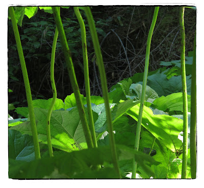
Umbrella plants in Fiddle Creek