Wednesday, July 11, 2018

THE SIERRA BUTTES Part 2: TRAILS to YOUNG AMERICA LAKE and MOUNTAIN MINE

Sardine House was the residence of the ditch tender who kept an eye on the ditch from Lower Sardine Lake to the Sierra Buttes Mine. In 1886 the owners of the Young America Mine completed a road to Sardine House and then on to the mine.  The former location of Sardine House is at the current intersection of the road to the Lower Sardine Lake and the road to Packer Saddle.  Today, where the road forks, there are two trail heads.  

A photograph of Bassett's Station (circa 1880) shows the road to the Mountain Mine
Photographer unknown

The Mountain Mine Road
On the south side of the road split is an enormous roundish boulder with a dirt road originating at its base.  This is where you park and begin walking south – it's impossible to get lost.  The road crosses Sardine Creek which can run high but there's always a constructed way across the stream.

Trail map to the Mountain Mine

Almost any hiker can manage this 6-mile round trip with a 1,450' elevation gain.  It's on a scenic road to the Mountain Mine, which sits just below the summit of Sierra Buttes. Parts of the road are supported by dry stacked rock retaining walls and other segments are blasted into the hillside. This is a splendid big-sky walk with views of the North Yuba, Flume Creek and the Sierra Buttes.  The road is rocky so it's important to wear appropriate shoes and there is little shade therefore a hat and sunscreen is advisable. 

Volcano Lake

On the way up is crystal clear Volcano Lake at 6,350' situated at the end of a short spur road and definitely worth a visit.  It can be also be the destination for a shorter day hike. Volcano Lake is on land purchased by the Sierra County Land Trust who continue to buy land for the public to enjoy in the Sierra Buttes-Lakes Basin area.  We appreciate it!
 
The Sierra Buttes and Flume Creek

The setting of the Mountain Mine is incredible. It's in the steep and barren Flume Creek drainage originating on the east side of the Sierra Buttes.  There is little to see now because harsh weather conditions have eliminated any standing structures.  In 1885 it was owned by Henry Warner of Sierra City.

A quartz ledge at the Mountain Mine

 According to the 13th Report of the State Mineralogist (1896) they mined five quartz veins thought to be an eastern extension of the Young America ledge by using three tunnels, two of which pass entirely through the ridge.  Ore was delivered to a 40-stamp water-powered mill by a 6,000' long wire rope tramway carrying 400 pound buckets.  Power was provided by a four foot Pelton Wheel using water from a 3/4 mile ditch and flume from Sardine Creek and the North Yuba.  The mine typically processed 125 tons of ore daily and employed 55 men but was, at the time of the visit, "temporarily closed by litigation."

In 1905 the mine and mill were still operating and owned by a mining and investment company based in San Francisco & New York (Register of Mines and Minerals for 1905. California State Mining Bureau).

• • •


TAMARACK CONNECTION TRAIL, then overland to YOUNG AMERICA LAKE
The Tamarack Connection Trail is on the north side of the road split and it's clearly marked.  By walking this trail to the ridge top and then following the narrow ridge to the southwest it's possible to drop down to Young America Lake.  It's a roughly a seven mile hike round trip with an elevation gain of approximately 1,650'.  

View of the Sierra Buttes and part of Lower Sardine from the Tamarack Lakes Connection Trail

Trail Map to Young America Lake
After several switch backs in a forested area the trail climbs gradually to the southwest at about mid-slope for approximately a mile then climbs more abruptly to the northwest via a few switchbacks to a narrow ridge on a northeast-southwest axis.  Here you will see a trail to the southwest – take it.  It's a pretty good trail for about a mile and then it starts to get sketchy. Basically it gets steeper on the south side of the ridge as you proceed and you want to stay close to this side. There are occasional ducks (stacked rock trail markers) but you can't really depend on them being there.  The trail sometimes appears then disappears and you will get glimpses of Tamarack Lake downslope to the northwest. 

This is the ridge line south of the lake showing the notch and chute that offer access. You descend (and ascend) at that small cluster of conifers in the center of the photo.

Eventually you'll see a dramatic unclimbable spire on the ridgeline – move towards it. Just before you reach it there is a notch where you can climb down to dramatically situated Young America Lake.  This is not an easy descent and it's helpful to have gloves to grip the sparse but tenacious vegetation.  If you feel that it's too dangerous – trust that feeling and back off – no shame here, call it smart.  It's often easier if you have the encouragement of a companion or two but keep in mind that you'll be climbing out too.

Young America Lake and the Sierra Buttes

 In the basin there are massive slabs of rock strewn about, some of them even tinkle like giant porcelain platters as they rock and bang against each other while you navigate this impressive landscape in which you are nothing but a tiny soft creature.  Young America Lake at 7,250' is dramatically nestled in a depression 1,337' directly below the Sierra Buttes.  Downslope to the northeast are Sardine Lakes with Haskell Peak off in the distance. This is a stunning landscape in all directions.  There are few trees here – you'll be glad that you brought plenty of water.  If you take a dip I can assure you that it will be cold because it's pure snowmelt that gets rechilled every night.

The south wall of the Young America Lake basin 
• • •


THE SIERRA BUTTES and LOWER SARDINE LAKE – NORTH YUBA


Dawn on Lower Sardine Lake
Recently my wife Carol and I spent a few days at Sardine Lake, just below the Sierra Buttes, near the North Yuba.  It's a gorgeous place!  The area north of the Sierra Buttes and south of Mohawk Valley contains something like 50 lakes and ponds.  Between Upper Salmon Lake and Gold Lake a ridge divides the watersheds of theMiddle Fork of the Feather River and the North Yuba.  The Nisenan, Maidu, Washo, and the unnamed people who preceded them, visited this area for thousands of years.

Lower Sardine Lake, circa 1890s.
Photographer unknown
By 1850 miners were searching for gold in the region.  They came to this remote place based on the delusions of a man named Stoddard who traveled to Marysville, Nevada City and other places displaying a few nuggets that he claimed came from a mountain lake with quantities of gold on its shore.  While at the lake he was driven off by Indians and was trying to get together a party to join him in finding the lake again.  About 25 men joined his group while another 500 to 1,000 gullible gold seekers followed behind.  Sierra and Plumas County historians, Farris & Smith (1882), called it "A perfect stampede".  The gold seekers never did locate the bountiful lake, but while there they prospected and found lode gold near the Sierra Buttes and placer gold at Rich Bar on the Middle Fork of the Feather among other discoveries.

The beauty of the Sierra Buttes and Lakes Basin region did not go unnoticed.  In 1858 the Coleman House at Gold Lake ran this advertisement in the Sierra Democrat: “The house is supplied with the conveniences of a first-class hotel, and in addition, there is every facility for rowing and sailing on the Lake, hunting on shore, fishing, bathing, and every other character of diversion to be expected in a resort of this character.”

Bassetts Station, 1910. Note the Bear hide on the right front fender.
Courtesy of the Sierra County Historical Society Museum at the Kentucky Mine

In the early 1860s William G. Hancock opened a way-station where Howard Creek enters the North Yuba, near the present-day intersection of Highway 49 and the Gold Lake Highway. Chris Tegerman bought it in 1865 and it became the Howard Ranch.  When the Yuba Gap Wagon Road opened in 1870, Jacob and Mary Bassett bought the ranch and renamed it Bassett's Station.  The Bassets built a large log structure and two barns, one for horses and another for oxen. They also maintained a blacksmithing shop, a sawmill and a boarding house for sawmill workers and miners.  There was even access to a telegraph.  In 1900 breakfast and lunch cost 50 cents and supper $1. You could spend the night and have hay for your horse for $1.  Nearby a sawmill operated from the mid 1880s to the early 1900s.

The late nineteenth century brought a surge of interest among Californians in natural environments for relaxation and recreation.  Outdoor camping and mountain climbing were important aspects of this movement and had a special appeal to city people.  There was even a form of medical treatment known as the "wilderness cure." Early in the twentieth century, appreciation of the outdoors had become a national cult and perhaps nowhere held more appeal than did California. 

The North Yuba became a popular area for summer resorts, especially those in the vicinity of Goodyear's Bar, Downieville, Sierra City and Gold Lake.  Among the local resorts were the Diamond L Ranch at Lusk Meadows which opened in 1908, offering fishing, hunting and excursions on horseback with 13 cabins available to visitors.  The McGee Resort opened on Upper Salmon Lake in 1910.  When the three Christian brothers took over in the 1930s they built 40 cabins and platform tents and renamed it the Salmon Lake Resort.  Packer Lake, a favorite camp spot for pack trains, became the Packer Lake Resort in 1926.  When the Browning family acquired Sardine Lake in 1935 they built a structure in 1941 and by 1946 they offered six rental cabins and called it the Sardine Lake Resort.

McGee's Resort at Salmon Lake, 1925
Photographer unknown

After the Depression the Tahoe National Forest began hiring professional landscape architects to design campground facilities.  A major attraction in this area is the Sierra Buttes Fire Lookout, first built in 1915-16 and replaced in 1964.  The lookout is 8,587' in elevation and is definitely worth the climb.  Aircraft have replaced lookout towers, in part, because their radius of effective fire detection doesn't usually exceed 15 miles.

In 1886 the Hayes-Steelman Road connected Bassett's and Gold Lake and it was realigned and reconstructed in 1913.  In the 1960s the Forest Service constructed a good road to Gold Lake and in 1972 extended it to Mohawk Valley in Plumas County.

A trail over Yuba Pass opened in 1852, expressman Sam Langton, and others still used it in 1863.  Before the opening of the Yuba Gap Wagon Road in 1870, Sierra County produced about 2,000 bales of hay.  When freight wagons started using the new road over the summit production immediately increased to 11,000 bales.  Most of the hay, essential to feed oxen, horses and mules, came from Sierra Valley.

The Harris & Freeman Stage between Blairsden and Sierra City.
Courtesy of the Sierra County Historical Society Museum at the Kentucky Mine

Stagecoaches, weighing about 2,500 pounds, carried nine to twelve passengers inside and up to a dozen more on its flat roof.  Reinsmen were often called “jehus” after the biblical charioteer, described thusly: "for he driveth furiously".  On steep uphill grades passengers were expected to get out and walk and men were expected to push.

The economy of nearby Sierra City depended entirely on hardrock, or lode mines.  Ore was usually mined underground and then transported to the surface, where it was crushed and processed for its gold content.  Sierra City enjoyed prosperity between 1870 and 1914.  Its most successful mine, the Sierra Buttes Mine,discovered in 1850, sold in 1870 for $1 million to London-based investors.  They made significant improvements in its operations, by 1882 the mine's three mills had 96 stamps in operation.  In 1888 the mine employed 209 men at an average wage of $50 per month with board.  The Sierra Buttes Mines produced between $17 and $20 million in gold.

Part of the tram at the Young America Mine on Lower Sardine Lake.
Photographer unknown
YOUNG AMERICA MINE
Oliver Sunderhaus and Philip Deidesheimer located a mining claim on the north slope of Lower Sardine Lake in October of 1883.  In 1885 they opened the Number 1 Tunnel and took close to 100 pounds of the rich ore to Downieville.  The Mountain Messenger enthused, “It is a fine a lot as can be found anywhere.  The Young America has every appearance of being a bonanza”.  Within a few months a wagon road from the Gold Lake Road, a ten-stamp mill and a boarding house were completed.  Next a 3,200 foot cable tramway was constructed to deliver ore to the mill.  By 1886 there were 40 stamps dropping at the Young America Mine where a December clean-up of 25 day's work yielded $25,563.

The holdings of the Young America Consolidated contained four lakes.  The uppermost is Young America Lake which functioned as a reservoir for snowmelt.  Upper Sardine Lake provided water for the operation of the Young American mill and hoists located on the north shore of Lower Sardine Lake.  Below Lower Sardine was a wetland where the tailings were impounded – today it is a recreational area known as Sand Pond.  The gross proceeds of the mine and mill for the year ending August 15, 1886 amounted to $294,000. 

The Mountain Messengerof January 12, 1889 posted an article describing a lively event at the mine.  Three carriage loads of revelers and one of Sierra City's two brass bands were invited to the Young America Mine where "Lower Salmon Lake was brilliantly illuminated with bonfires and skating was indulged in until after midnight, the skaters keeping time to the sweet and enlivening music of the "Spanish Band". This sounds like a wonderful time and I'm sorry I missed it, but reading about it made me remember a time in the early 1980s, when I was cross-country skiing with my late wife Susan on Lower Sardine Lake. It was a beautiful day in March so we decided to soak up all the sun we could by skiing naked.  It was exhilarating and Susan looked mighty fine gliding around in such a gorgeous setting.  After about 30 minutes or so we realized that we could get burnt in seldom seen places so we dressed and skied on, laughing all the way.

One of Sierra City's brass bands.
Photographer unknown
Several offers to purchase the mine were made in 1889 – the owners were asking a million dollars. In the same year a representative from the State Mineralogist visited the mine. He reported that 120 men were employed; 72 of them worked in the mine earning an average of $2.50 a day while the six men in the mill made $3 a day and the 42 men who worked outside as timbermen, teamsters, breakmen, blacksmiths, etc. were paid $2.25 a day. A six foot Pelton Wheel powered the 40-stamp mill and a three foot wheel ran the air compressor.

Workers from the Young America Mine pose on a flume. The Lakes are Upper and Lower Sardine.
Photographer unknown

The average monthly clean-up of the Young America from September of 1885 through 1890 averaged about $20,000, but began to decline at the end of that period.  Production of high grade ore in the latter part of 1891-1892 decreased significantly and the mine owners found themselves in financial trouble.  In April of 1892, instead of a dividend, an assessment was levied on the stock held by the owners.  There was very little work done in 1892-3.  In all the Young America produced over $1.5 million, making it one of the richest mines in this area.  According to the 13th Report of the State Mineralogist (1896) the Young America was no longer operating but was recently sold and a cyanide plant was erected to process the tailings.

Today the water of Lower Salmon Lake is clear and the mine's 40 stamp mill is no longer pounding and clanging away.  If you were visiting here 130 years ago you would have encountered an industrial setting with an entirely different atmosphere.
• • •

Saturday, June 16, 2018

ARTIFACTS: OUT OF CONTEXT


Artifacts are objects that were intentionally designed and shaped through human efforts.  Manufacturing waste such as a flake scatter or mining tailings, although not created deliberately, convey information too.  Artifacts, and the context in which they are found, help archaeologists describe and compare aspects of past cultures, as well as help to form a chronology of those cultures. 

Most artifacts are not treasures, in the popular sense.  The information or value comes primarily from an artifact's context, or where it is found and its relationship to what other items are recovered.  To record context, the archaeologist takes care to document the artifact's exact horizontal relationship to other artifacts and features and its stratigraphic position.  Each step of the excavation is recorded with detailed maps and photographs of the site.

Context then, is a big deal in archaeology and it's unfortunate to see a single "choice" object taken from a site and reduced to a mere curio because it has no context or story.  Indigenous people see disturbing a native archaeological site as a transgression.  Shelly Covert, spokesperson for the Nevada City Nisenan, says that looting is “separating the artifact from the land.” Artist Judith Lowry, also of Nevada City, is of Pit River and Mountain Maidu ancestry and she says that taking artifacts away is “disturbing the story.” In addition to being ethically shaky, "collecting", as looting is sometimes called, is against the law on lands managed by the federal government.


Of course there are isolated finds with no accompanying context.  It's not uncommon to find a single projectile point that might have come from a wounded animal that got away from the hunter but eventually died where the point was found – but this is pure conjecture.  While hiking I came across an empty iron flask that once held 75 pounds of quicksilver (mercury) on a steep slope in a remote part of the South Yuba Canyon – who knows what the story behind this find is?

An artifact apart from its ability to provide information about the past, has a presence on its own.  Now this is not science, but a shaped hand-stone, milling stone or "mano" can have a pleasing heft, an aesthetic sculptural dimension, a sensual wear pattern and a cleverness of design in its specialized surfaces created for different purposes.  Some humble tools found at sawmill or mining sites are improved as aesthetic objects by rust and corrosion (remember Neil Young's Rust Never Sleeps album?).

With artifacts, especially those out of context, there is always an ambiguity factor.  I think I can detect a change in the perception of the beholder when I refer to an artifact as “art” versus “a tool.”  I'm also a photographer who delights in the ambiguity of the medium – I love to photograph artifacts without scientific "objectivity" and to flirt with invented context.  There is a playfulness that comes with responding to the pure object without archaeological baggage.

So here's a small portfolio of artifactual photographs, out of context.  All the artifacts were found in the Yuba River basin.

A pestle with a beautifully beveled milling surface


Milling stone with a curved milling surface and a flat,battered end


Candle holder, the lid of a sardine tin and an amalgam scoop


A milling stone deliberately shaped to include a diagonal stripe


Chinese opium tin, flattened


Box of basalt projectile points


A mysterious slab of shaped granite with an eye bolt


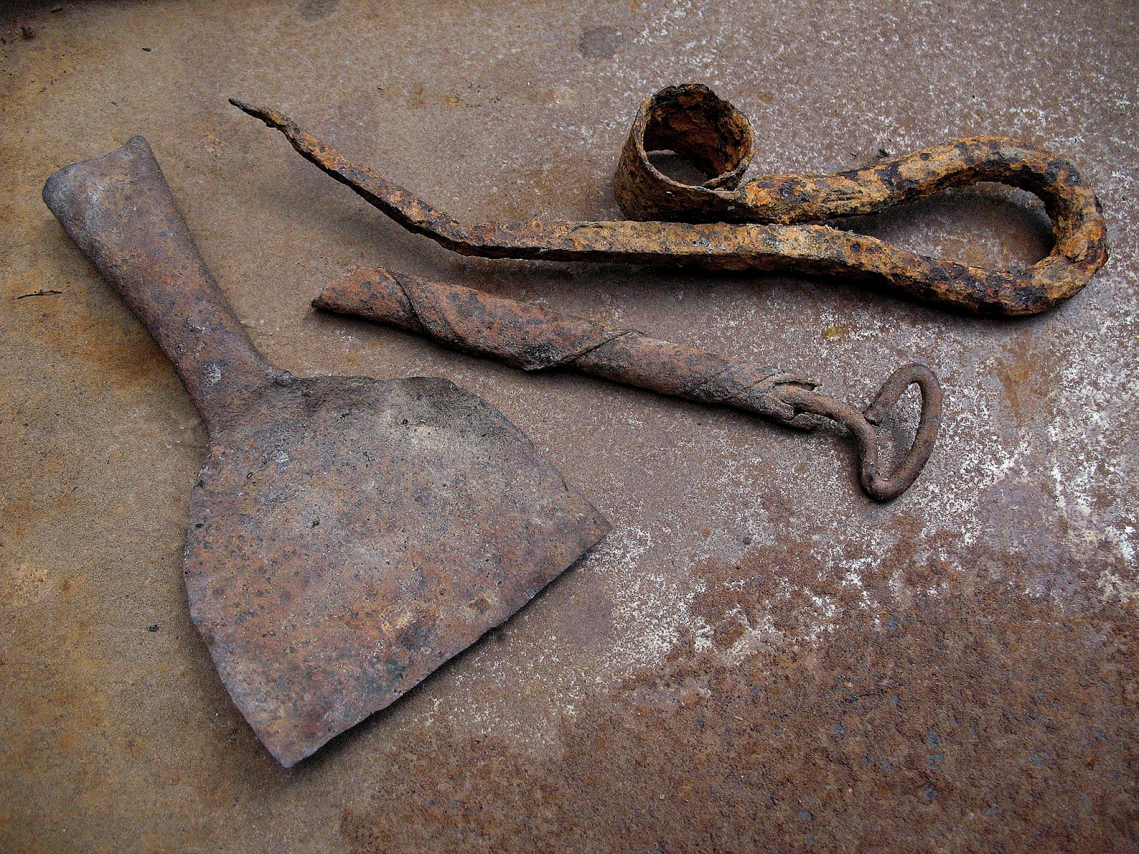
An appropriate accessory for the Blacksmith's Ball


Either a knife or spear point of silky fine-grained basalt


Manly tools


Tuesday, May 15, 2018

HYDRAULIC MINING IN THE YUBA AND BEAR RIVER BASINS

Omega Diggings / South Yuba

"No other mining process is so extravagantly wasteful."
F.W. Robinson.  Report of the State Mineralogist 1882

Ditches, dams, diggings and tailings are commonplace in the Yuba and Bear River watersheds.  On almost any hike or ride it's only a matter of time before you'll encounter features associated with hydraulic mining.  Despite only 30 years as the dominant gold mining method the scars of hydraulicing, both visible and invisible remain part of our legacy.  The footprint of hydraulic mining is massive not only in the geographical, geological and hydrological realms, but also in its innovations in technological and hydraulic engineering and in the creation of an elaborate body of laws pertaining to water and mineral rights in California.

In order to understand why the Yuba and Bear River basins were so well-positioned for hydraulic mining let me attempt a rudimentary explanation of some local geology.  Approximately 60,000 years ago ancient auriferous (gold bearing) streams were flowing in this region.  As the Sierra Nevada formed and rose in height streams began to flow in west and southwesterly directions.  The continuous down-cutting of streams eventually exposed gravel deposits from the ancient streams that are as high as 1,000 feet above today's rivers and creeks.  Gold miners, intent on finding “the source” of Yuba River gold, explored all of the gold-bearing tributaries but found instead “high gravels” or Tertiary gravels, at mid-slope between the major streams and the ridgetops.  An example is the area around Banner Ridge, which was discovered in 1850.

Gravels near Red Dog / Greenhorn Creek / Bear River

The mining of placers is not the same as popular images of underground hard-rock or lode mining.  Placer gold has already been eroded from its matrix and has been redistributed by alluvial processes.  In placer mining, gold, due to its high specific gravity, tends to gravitate to the stream bottom, which is typically bedrock. The same principle applies to ancient streams, therefore the yield per cubic yard of Tertiary gravel would be greater near bedrock.  To get to the bedrock requires removal of the overburden and for that task pressurized water is an ideal method. 

Fortunately for the miners many of the gravel deposits were easily accessible because the lava flows that once covered the ancient rivers had long ago eroded away.  Banner Lava Cap was so-named for the remnant lava flow "capping" the auriferous gravels of Banner Ridge.  The hydraulic method was the ideal way to mine gravel deposits because the yield per cubic yard was so low that a great volume of gravel had to be "washed" in sluices for it to be profitable.  And finally there was generally plenty of water available which was essential for hydraulicking.  Of course a technology to transport water from the high mountain streams had to be developed, which the miners did, and in so-doing became a world recognized center of hydraulic engineering.

LaPorte / Slate Creek / North Yuba, n.d.
photographer unknown

The Northern Mines, in the watershed of the Feather and Sacramento Rivers had the highest concentrations of auriferous gravels – from north to south they were: the Slate Creek region (Plumas and Sierra counties), the San Juan Ridge (Nevada County), and the Quaker Hill, Red Dog, Gold Hill and Dutch Flat regions (Nevada and Placer counties).

DISCOVERY
In 1853 a new technique of mining was discovered on Deer Creek near Nevada City. It was called the hydraulic process and it was, by far the most efficient (and destructive) method of gold mining.  Hydraulic mining is the application of a jet of water under great pressure, focused by a nozzle, to a bank of placer alluvium consisting of compacted gravels. The idea was to let water do the work – water was used for its mechanical force and it was far more efficient than many men digging with shovels.  By using pressurized water miners saturated and cut the banks so that they were reduced to lava-like mud and stones, that slurry was then channeled to the sluicing area where the gold was recovered.  The hydraulic process became enormously popular and it was used wherever possible.

Malakoff Diggings, 1870s
Photo by Carlton Watkins

Phillip May, author of Origins of Hydraulic Mining in California (1970) has extensively researched the topic and concludes that hydraulicking most likely first occurred on Buckeye Hill, east of Nevada City near Greenhorn Creek.  Antoine Chabot, William Matteson and Eli Miller, a tinsmith, were partners on a Buckeye Hill claim in 1852.  May maintains that it was Chabot and Miller who applied a nozzle to the hose thereby improving the aim of the water and increasing its velocity.  Matteson introduced the process to his claim on American Hill in Nevada City in 1853, where it was more likely to be chronicled. Matteson is generally recognized as the discoverer of hydraulic mining but it appears to have been a collaborative invention, if it can even be called an invention.  After all, the hose and nozzle were already in use by local firemen. The innovation was the application of an existing technology (pressurized water) to gravel banks in order to access the compacted auriferous gravel.  Matteson’s Nevada City claim was on American Hill, near Buckeye Hill Ravine, just west of town.  The origin of the hydraulic process wasn’t discussed in the press until 1857 when a story ran in Hutchings California Magazine, four years after its invention.  This was more than ample time for the facts to be amended or distorted in the retelling.

DAMS/WATER CONVEYANCE/DISTRIBUTION
In California precipitation is seasonal, occurring in the winter and mostly stored in the form of snowpack.  Hydraulic mining required water year-round and plenty of it. To provide that water companies consolidated and built bigger reservoirs and higher capacity ditch systems.  In the diggings water was used as a direct power source.  

To the mine owner, once the muddy gravel exited the sluice system the mining process was over.  The problem of accumulated tailings or mine waste on site made it difficult to continue mining so it too was pushed into adjoining creeks or to a drain tunnel.  This nasty torrent of mud and gravel eventually made its way downstream where it caused unprecedented environmental degradation.

As hydraulic mining grew so did the water companies and the scope of their operations.  Water companies built storage dams, both large and small, beginning in the 1850s. Typically small owner-operated mines went into debt by purchasing water. Most of them eventually forfeited their mines to the water companies who ultimately owned both the mines and the infrastructure that provided them with water.  Water was transported in ditches and flumes sometimes over long distances: North Bloomfield Company's main ditch was 55 miles long, the Milton Ditch was 63 miles, the Eureka Lake Company's ditch was 34 miles, Blue Tent Company's was 33 miles long and the South Yuba Canal was 123 miles long. Before long the major companies constructed high-capacity reservoirs to redistribute water to various mining operations.  Their success attracted investors from San Francisco, New York and England.

Tertiary gravels were easily recognized because they had the same rounded gravel, cobbles, boulders and gold as today's live streams.  But the gravels were difficult to access because they were compacted into the soil structure with tons of “overburden” consisting of soil, vegetation, trees, and low-yield upper gravels to remove. 

Kennebec Mine /Birchville/  Middle Yuba
Photo by Lawrence & Houseworth 1860s

PIPING
Water cannons, generically called "monitors", were used to mine gravel banks and the process was called piping.  They had nozzles, available in different sizes, and had sophisticated features resulting from endless experimentation.  Manufacturers gave them manly names like Globe Monitor, Hydraulic Chief, Hoskins Dictator, Little Giant and Hydraulic Giant.

In a well-financed operation two, and sometimes more, monitors were used on a particular bank. One of them was used to saturate the bank while the other undercut the same area.  Another option to bring down the gravels was to construct tunnels at the bottom of a bank and load them with explosives.  

SLUICING
The sluice was essential – this is where the gold was recovered by gravity separation.  A sluice box is essentially a long, slightly inclined, rectangular trough through which a rapid stream of water and auriferous gravel flows.  The bottom is provided with slat, block or rock riffles. Because of the great weight of gold gravity causes the gold to sink and collect in the spaces between the riffles. In hydraulic mining, sluice boxes were fitted together to extend for hundreds of feet and in some cases, like on Greenhorn Creek, a tributary of the Bear River, they were miles long.

Quicksilver, or mercury (Hg), was routinely added to sluices to amalgamate with the finer particles of gold. Miners tried to recover what mercury they could to save on costs but they lost an estimated 10 million pounds to placer mining statewide and 80% to 90% of that was in the Sierra Nevada. Hydraulic mines lost an average. of 10% to 30 % of the mercury that they used.  To this day mercury is systemic in the Yuba and Bear River basins.  It is largely inert and poses no immediate danger but in reservoirs it can bioaccumulate in fish.  Scientists from the United States Geological Survey (USGS) have determined that "... the South Yuba, Deer Creek and Bear River watersheds have elevated concentrations of bioavailable mercury (2000)."

Drain tunnels were unique to the Northern Mines – they were expensive but they served two purposes.  They were designed to transport tailings away so that work could continue unimpeded (in its heyday North Bloomfield operated around the clock) and the tunnel provided another opportunity to sluice the tailings.

Tailings in the Greenhorn Creek Drainage / Bear River

MINE WASTE,TAILINGS, DEBRIS or SLICKENS
After sluicing, the tailings, mostly a slurry of mud and gravel, was dumped into nearby ravines and sent downstream.  Thus ended the involvement and concern of the hydraulic mine owners.

The center of the hydraulic mining industry was the Yuba's three major forks and the upper reaches of the Bear River.  In the 1860s Nevada was the leading mining county in the state with many of its most productive hydraulic mines found on San Juan Ridge, between the Middle and South Forks of the Yuba.  A contemporary Civil Engineer reported, “so great has been the quantity of ground washed away, that many of the ravines are covered with a depth of twenty feet and upwards of tailings from the sluices.”   

In 1862 the Homestead Act was passed and by 1865 patented mine ground was made available. New laws granted water companies legal right-of-way and a formal survey by the Government Land Office was in process.  When the transcontinental railroad was completed in 1869, 10,000 Chinese laborers went looking for work.  Many of these men transferred their construction and blasting skills to hydraulic mining endeavors.

Towns developed near all these operations, and hundreds of miners and businesses became dependent on their wages for survival.  The mining industry was the source of local employment and was usually allowed to proceed with their plans regardless of consequences.  In the mid-1870s the settlements of Moores Flat and Columbia Hill on San Juan Ridge were moved, despite protestations, because they were on mining ground. Moores Flat even had to move the town's cemetery.

The key to success in hydraulic mining was the control and application of huge volumes of water.  Thus, by the 1870s and 1880s, ''ditch" or water companies consolidated to create large corporate entities whose stock traded on the San Francisco exchange.  The largest companies included the Milton Mining Company, the North Bloomfield Mining Company, the Eureka Lake and Yuba Canal Company, the South Yuba Canal Company, and the Bear River and Auburn Water Company.  By the 1880s hydraulic engineers and mine managers like Hamilton Smith, of the North Bloomfield Mining and Gravel Company and Alvinza Hayward of the South Yuba Canal Company were considered the best in the world and were greatly admired.  Unless you lived downstream.

Tailings on the Lower Yuba near Smartsville, 1860s
Photo by Lawrence & Houseworth

DOWNSTREAM
On their way downstream the tailings changed stream geomorphology, caused immense siltation, created large gravel bars, raised water levels, buried mining claims and distributed mercury.  At the same time activities ancillary to gold mining like lumbering, ranching and market hunting amplified the environmental havoc.

Once downstream, in the flatlands, accumulations of mud and gravel from the upstream mines spread out covering valuable agricultural lands, hampering river navigation and causing flooding.  The gold mining culture of the foothills had little compassion for the valley people. The farmers were advised to adapt to an unfortunate consequence of doing necessary business.  There was an arrogance about people of the gold regions.  Wasn't it mining, not agriculture, that created California – after all, the state motto is "Eureka?"

Meanwhile the transcontinental railroad was completed in 1869 thereby opening a national market for California agricultural products and generating far more capital than gold mining.  By the late 1870s the controversy was raging.  Some farmers were ambivalent because they too profited from the prosperity that gold mining brought.  But the situation only worsened and could no longer be overlooked.

DOWNSTREAM TROUBLES
As the upstream hydraulic mines were prospering farmers in the Sacramento Valley were continually dealing with high water and extreme siltation.  Effects of the mining debris on Sacramento Valley farming was noticeable about 1860.  In that year Bavarian Eduard Vischer was visiting the mines and was impressed by the hydraulic mining process but in Marysville he saw the downside of mining.  He described the tailings in the Yuba and Feather Rivers as "... a reddish, thick, opaque mush.  Whosoever observes these mountain region waste waters heavily laden with mud will no longer be surprised at being able to recognize the Sacramento River by the color of its water far into the Bay."

The big flood of 1862 inundated farms and flooded municipalities in the valley and left a sediment on the lower Bear River about two feet thick which caused great alarm.  This was one in a series of episodes caused by the voluminous discharge of tailings from the hydraulic mines in the mountains.  Then Marysville was flooded in 1875 causing an uproar.

G .F. Keller 1881

Charles Nordhoff published California for Health, Pleasure, and Residence for Travelers and Settlers in 1873.  It was an extremely popular guidebook that persuaded many to settle in California.  He had this to say about the Yuba River near Smartsville,"This was once, I am told by old residents, a swift and clear mountain torrent; it is now a turbid and not rapid stream, whose bed has been raised by the washings of the miners not less than fifty feet above its level in 1849.  It once contained trout, but now I imagine a catfish would die in it.”

In 1876, James Keyes, representing the farmers of the Bear River Valley, filed for a perpetual injunction against the Little York Gold and Water Company and 18 other hydraulic mining companies on the upper Bear River.  Among them were the mines of Quaker Hill, Buckeye Hill and Hunts Hill.  A. A. Sargent of the Sargent & Jacobs mines on Quaker Hill and Hunts Hill scoffed and said that “stopping hydraulic mining would throw half of the people in the mountains out of work and bankrupt all government in the area.” 

If you want to see an accumulation of tailings on the Yuba River once it reaches the valley floor I suggest driving State Highway 20 to the Yuba River crossing at Parks Bar.  Immediately downstream are tailings consisting of fine sand and gravel estimated at one to three miles wide covering an area of about 25 square miles.  Now imagine this gravel in motion, much more muddy and replenished annually.

SAWYER DECISION 1884
In the late 1870s the annual value of the dry farmed wheat crop alone had reached $40,000,000, more than double that of the dwindling gold output.  According to geographer David Larsen, "The trend was clear and irreversible the pivot of prosperity had shifted permanently toward the fields."


FIRST ENVIRONMENTAL LAW?
Obviously, by outlawing the dumping of tailings there was improved water quality and fish habitat and there would be less toxins inadvertently released but this particular environmental remediation was incidental to the intent of the law.  Except in a very general way there were no environmental considerations addressed in the 24 volumes of testimony that were collected for Woodruff vs. North Bloomfield Mining and Gravel Company. This law was not created out of respect for Gaia, or any consideration whatsoever for stream ecology.  Simply put, the issue was business interests in the Sacramento Valley (agriculture) were losing income to the wasteful procedures of a powerful upslope industry (hydraulic mining).  Specifically agricultural lands were being covered with choking mud, towns were periodically flooded and steamboat operations were hampered by the decreased navigability of the rivers.  I can't see how the Sawyer Decision exhibits environmental activism but it does represent the beginning of regulations in the public interest.  The Sawyer Decision effectively limits the ideology of laissez-faire, which legitimized the single-minded pursuit of wealth at all costs.  This alone is a very big step in the direction of conservation and sustainability.

CAMINETTI ACT 1893
The Sawyer Decision did not ban hydraulic mining, it banned the dumping of mine waste into the watercourses.  The Caminetti Act sought to resume hydraulic mining by creating upstream debris dams to impound mine waste or tailings.  It was attempted, but somewhat half-heartedly, because the early dams were brush and cribbing dams that were lucky to last a season.  Among other places, there were dams built on Scotchman's Creek, Willow Creek and Horse Valley Creek followed by more substantial concrete dams at Daguerre Point (1906), Bullards Bar (1924) and Englebright (1941).

Debris Dam at Malakoff Diggings / Humbug Creek / South Yuba, n.d.
Photographer unknown

The Caminetti Act also created a Debris Commission consisting of  three officers from the Army Corps of Engineers.  They set up a permitting process and fee schedule that further discouraged the resumption of hydraulic mining.  In 1909, 33 applications for permits were received and 16 were granted.

LEGACY
We have a legacy of diggings, or mining excavations– monuments, really – to our industrial past.  Because of hydraulic mining we've also inherited a watershed-wide dispersal of mercury (below 6,000') with well-documented toxic effects.  It pains me to remind you not to eat the fish from reservoirs.

An elaborate system of dams and ditches is part our legacy. Some of them have been adapted, and new one's built, for hydroelectricity and irrigation.  It seems to me that that more of them can be used as trails and be incorporated into the watershed's transportation, recreation, and public health (fitness) system.

I continually marvel at the amount of devastation and degradation caused by hydraulic mining.  The basic ingredient was human ingenuity powered by the simple principle of gravity and aided by picks and shovels to dam and manipulate water.  The addition of quicksilver to sluices enhanced the mining process but contaminated the ecosystem.  It seemed like progress at the time and the whole community supported it, but there were unseen consequences.

Siltation at the Mouth of the South Yuba at Point Defiance