Thursday, March 28, 2019

KANAKA ADVENTURERS: HAWAII’S ROLE IN YUBA RIVER HISTORY

Race Track Point, near Slate Range Bar/ North Yuba River

Originally “Kanaka” referred only to native Hawaiians, who called themselves Kanaka Maoli, but broadened to include all Pacific islanders employed primarily by the British.  For this post I’ve narrowed the focus of their history to include only the Feather and Yuba Rivers and the adjacent Sierra Nevada foothills.  For centuries before the appearance of Euro-Americans and Asians this was predominantly Konkow and Nisenan territory

There’s a lot of variation in the spelling of Hawaiian person and place names in the historic record.  I’ve tried to corroborate different spellings, but ultimately had to decide on one version.  Hopefully I haven’t inadvertently garbled translation.
  
HAWAIIAN INVOLVEMENT IN MARITIME TRADE
Beginning in the early 19th century Hawaii became a center of activity for Pacific maritime trade because of its strategic location.  Even before Kamehameha’s unification of the Islands, chiefs were already involved in trading sandalwood to obtain Asian and western goods such as nails, cloth, tools and weapons and it was an essential stop to resupply water and fresh food.

While hides and tallow were being shipped from the Mexican ranchos of Alta California the Russian, English and American fur trade was flourishing on the Pacific Northwest coast of North America. Whaleships from New England entered Hawaiian waters in 1819 – they were the first of thousands to follow.  In 1846 Pacific whaling grew so rapidly that 736 whaling ships arrived in Lahaina Bay.  Whaling ended in 1859 when oil was discovered and developed in Pennsylvania; within a few years this new type of oil replaced whale oil for lamps.

A triangular trade network emerged linking the Pacific Northwest coast, China and the Hawaiian Islands to Britain and the United States (especially New England).  In the 1820s Hudson’s Bay Company already spanned an area of more than 700,000 square miles that stretched from Russian Alaska to Mexican California and from the Rocky Mountains to the Pacific Ocean. The Company was attracted to Hawaii as a potential market for the products of the Company's posts in the Pacific Northwest. Their primary products were salmon and lumber.

Kanakas were highly valued as crew members on the ships that transported trade commodities because they were excellent seamen, strong workers and they were dependable.  Men from the islands were continuously offered employment on merchant vessels where they traveled far from home for long periods of time.  By 1844 between 300 and 400 Hawaiians worked for Hudson’s Bay Company in the Pacific Northwest, both in vessels and at posts.  Salt salmon became popular with Hawaiians, who would slice it up into small bits, and with the addition of tomatoes, green onions, water and ice would serve up a tasty dish called lomi-lomi salmon.  Today this is considered a traditional Hawaiian dish.  On the outgoing voyage from the islands, vessels carried Hawaiian salt, molasses, sugar and coffee.  At about the same time vaqueros from Mexican California were invited to Hawaii where they introduced cattle ranching.

The Hudson’s Bay Company typically offered Kanakas a three-year contract that paid $10 a month.  Hawaiian men were being offered employment on foreign vessels where they traveled far from home, for long periods of time.  To stem the flow of emigration from the Islands the Hawaiian legislature passed a law on May 4, 1841, requiring written consent and a $200 bond for employment at sea.  Under the terms of the agreement Hawaiian sailors were supposed to return to Hawaii within two years or the employer was subject to a $400 fine – in practice the law was unmanageable.

One of the unanticipated effects of foreign trade on the Hawaiian Islands was the devastation caused by infectious diseases.  Formerly isolated, the Hawaiian people were unusually susceptible to infectious diseases such as cholera, tuberculosis, smallpox, mumps, measles, whooping cough, venereal diseases and influenza.  Their population decreased from an estimated 200,000 in 1778 to 54,000 by 1876. Royalty was not spared either – when King Kamehameha II and Queen Kamamalu traveled to England in late 1823 they both contracted measles and died in July of the following year.

Trade involved more than the exchange of goods.  There were new foods, relationships and ideas to be exchanged when the Hudson’s Bay Company entered the Sacramento Valley of California.  They brought with them Kanakas and Aleuts while employing Miwoks and refugees from the recently abandoned Spanish missions.  There was also active horse trading going on between the Walla-Walla of the Columbia River basin and the Yokuts of San Joaquin Valley who used the Sacramento Valley as a corridor.  In this merging of mobile and rapidly changing ethnicities the lingua franca was Spanish and even before the gold rush the ethnogenesis of a new and supple Alta California culture was forming.

The Hudson’s Bay Company inadvertently introduced malaria to the Indians of the Sacramento and Feather Rivers, which reduced the native populations by 75% in 1833.  These were turbulent times for the indigenous people of the region.  Centuries old trade patterns as well as social, political and ceremonial practices were disrupted and obliterated calling for rapid reassessment and reorganization.  They could not have imagined that within a few years thousands more foreigners would invade and appropriate California in their lust for gold.

John Sutter was the first European to inhabit what we now call the Sacramento Valley. Originally from Switzerland, he came to the Mexican province of Alta, California in 1839 after spending five months in Hawaii.  Mataio Kekuanoa, the Governor of Oahu, gave Sutter permission to take ten Kanakas, one of whom was an Ali’i, to California.  The Ali’i were a class of chiefs and it was unusual for one to travel and work with ordinary Kanakas.

Sutter arrived in Yerba Buena (San Francisco) in 1839 after a visit to the capital in Monterrey where the Mexican Governor of Alta California gave Sutter a land grant of eleven square leagues (about 48,000 acres) in the lower Sacramento Valley in the borderlands between the Nisenan and Miwok peoples.  Sutter’s Fort (1846), considered an outpost of civilization, was the first destination of those who came to California by way of Oregon or across the plains. Sutter planned to create a vast agricultural empire, using indigenous labor, and call it New Helvetia.  His enslavement and harsh treatment of the indigenous people is well documented.  Governor Alvarado had to persuade Sutter to stop “the kidnapping operations” in order to prevent “a general uprising of Indians” within the Northern District. Sutter’s plans failed in an era of lawlessness that began in 1848 when gold was discovered on his land on the American River.

Ka'i-ana, Great-Great-Grandfather of Mary Azbill. A portrait hangs in the State House, Honolulu. 
The Dorothy Hill Collection and California State University, Chico, Meriam Library, Special Collections.

The Ali’i who accompanied Sutter was sixteen-year-old Ioana Keaala o’Ka'i-ana, the grandson of Ka’i-ana, the High Chief of Maui.  Why would an Ali’i travel and work with ordinary people?  Some historians speculate that Ioana Keaala had enemies because his grandfather resisted Kamehameha’s efforts to unify the Hawaiian Islands under his rule.  Ka’i-ana, chief of Maui, and originally one of Kamehameha’s counselors, was unlike the others – he had traveled to foreign ports, including Alaska and China – his sophistication and ambition may have generated jealousy and suspicion.

Kamehameha’s plan to unify all the Islands included subduing Maui.  Despite Ka’i-ana’s plans to attack Hawaii first, Kamehameha, with the aid of 16,000 men, guns and a cannon, surprised Ka’i-ana in a fight that destroyed the entire western side of Maui.  Ka’i-ana and a number of his men then joined forces with the chiefs of Oahu who were also under threat.  When Kamehameha struck Oahu, in the Battle of Nu’uanu, he used English cannons that could destroy stone barricades.  He also had the technical advice of two British sailors which gave a tremendous advantage to Kamehameha’s army.  Many warriors from the combined armies from Maui and Oahu, including Ka’i-ana himself, died in battle that day.  This was the decisive victory for Kamehameha and his campaign to unify the islands.

Either Ka’i-ana was an independent and conservative ruler who resisted western influences, or from the perspective of those who were in favor of unification, Ka’i-ana was a subversive.  The Governor and Chief of Oahu (Mateo Kekuanoa, nephew of Ka’i-ana) may have sent Ioana Keaala o’Ka’i-ana with Sutter for his own safety. Then again, Keaala may have been an exile, or adventurer, by choice.

In Californian Ioana Keaala became known as John Kelly. When Sutter’s empire crumbled during the gold rush John Kelly and other Kanakas went to work on the riverboats. Henry Azbill, the grandson of John Kelly, tells a story about his grandfather docking a boat at Chico Landing when a limb hit John Bidwell, owner of Arroyo Chico Rancho, on the head and knocked him overboard.  John Kelly immediately dove overboard and saved Bidwell from drowning.  Bidwell later became a prominent political figure on the county, state and national levels and was beholding to Kelly.

Bidwell’s Rancho was in what is now known as Konkow territory, which includes a portion of the Sacramento Valley floor and the Sierra Nevada foothills east of Chico and Oroville.  Konkow is an anglicization of the native Koyo-mkawi, which means “meadowland.”  It was in the village near Oroville called Taiyum Koyo, that John Kelly met and married Sumyneh, the daughter of chief Kulmeh. 
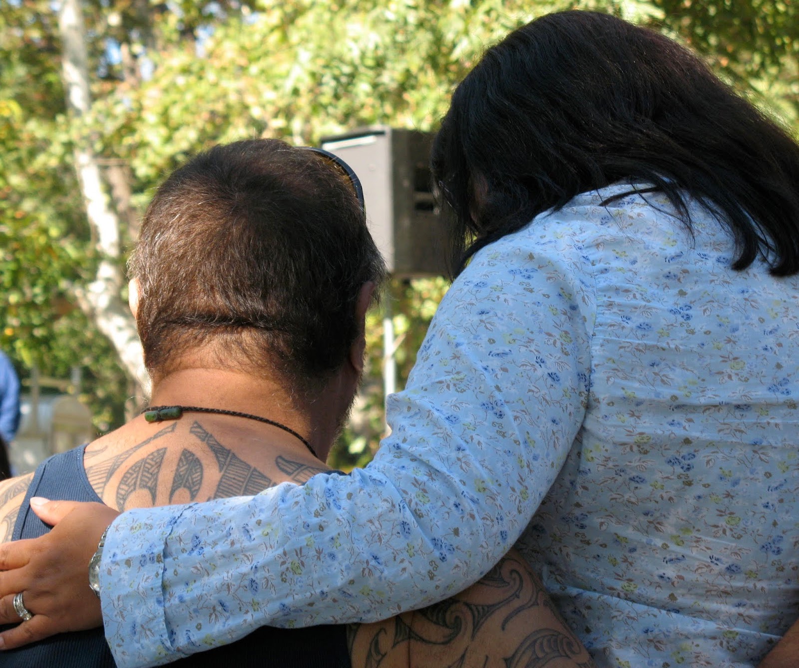

Kanakas generally preferred the company of the indigenous people – they treated each other as equals.  Newspaper, magazine and journal accounts were consistently derogatory and patronizing. Euro-Americans showed no regard for traditional boundaries and land use practices of the indigenous peoples.  The Konkow and Nisenan, like the Kanakas, valued cooperation more than competition and both the California Indians and they lived in accordance with the rhythms of nature instead of the Euro-American notion that the “frontier” was an inexhaustible resource to be manipulated at a profit.

The native people of the Sacramento, Feather, American, Yuba and Bear Rivers were excellent fishermen and so were the Kanakas.  Stephen Powers (Tribes of California, 1877), one of California’s first ethnographers, observed that the indigenous people of northern California, “were almost amphibious and rival the Kanakas in their capacity to endure prolonged submergence.”  The native Californians and the Kanakas had a strong genealogical relationship with the land which the Hawaiians called Aina. Kanakas, Nisenan, Miwok and others inter-married and their children had to make their home in the gold mining region but Kanakas writing home to the Islands usually referred to California as aina malihinior a strange land.  Poi, a Hawaiian staple made from the kalo, or taro plant, was unavailable in California but acorn mush or poi agore was in some ways similar.  Elements of the hula are still part of the traditional practices of the Shingle Springs Rancheria where Miwok, Nisenan and the “Sacramento-Verona Band of Homeless Indians” were granted a Rancheria in 1916.

Eighteen treaties were made with the Indians of California in 1851 and 1852 for reservations that would have comprised approximately 8.5 million acres. None of those treaties were ever ratified.  Instead, the government chose a policy of Indian Removal to regional reservations.  In the summer of 1863, hundreds of Indians from Yuba and Butte Counties were gathered together for relocation by the U. S. government.  Captain Augustus W. Starr and twenty-three cavalrymen of Company F, Second Infantry, California Volunteers, marched the Indians from Camp Bidwell to Nome Cult farm in Round Valley, Mendocino County.  Among the refugees were John Kelly, his wife and their two children, despite his insistence that he was a not an Indian, but a Hawaiian citizen.  Upon arrival at Round Valley, he wrote to King Kamehameha V explaining his situation. At the request of the Hawaiian King, John Kelly and his family were eventually released, and they returned to their Konkow village.

Mele' Keaala aka Mary Azbil, n.d..
The Dorothy Hill Collection and California State University, Chico, Meriam Library, Special Collections.

MELE’ KEAALA/ MARY AZBIL
John Kelly and Sumyneh had five children, Hiram, Sarah, Mele’, Hoku and Keaukuilani.  In the late 1860s Kelly was losing his sight and his youngest daughter Keaukuilani died. Then inexplicably, about 1870, he killed his wife and committed suicide.  The boys, Hiram and Hoku were sent to Vernon, where the Feather River enters the Sacramento River, to live with the Mahuka family, while Sarah and Mele’ remained in Chico.  Sarah eventually married Sam Frank of the Mechoopda village near Chico.  

Mele’ Keaala was born on December 24, 1864 in the Konkow village of Ta’yimk’oyo located near Yankee Hill-Cherokee Flat, between the North and Middle Forks of the Feather River.  She was christened Maria Guadalupe, but she was also known as Mele’, or Mary Kelly.  When Mele’ was 17 years old Hawaiian King David Kalakaua came to California.  While visiting Sacramento in 1881 he gave an audience to some Californians of Hawaiian descent and Mele’ was among that group.  When she recited her genealogy the King discovered that they were related and to formally recognize that relationship he appointed Mele’, Kai-Nuha Keaala, or Guardian of the King’s Kahili. A Kahili is a cylinder of feathers, a standard, mounted on a staff, that served as a symbol of royalty.  She was also invited to return to Hawaii with the royal family to serve as Lady-in-waiting to Queen Kapiolani.  Mele’ Kai-Nuha Keaala stayed in Hawaii for five years.  When she returned to San Francisco in 1887 as Lady-in waiting to Princess Lili’uokalani (King Kalakaua’s sister) the Royal entourage was on its’ way to Queen Victoria’s Jubilee in England.  Mele’, who was now 23 years old, asked for and received permission to visit her people. She married George Clements in 1887 and stayed in California to help Annie Bidwell at her Indian School, in Chico. While visiting San Francisco in 1891, King Kalakaua was taken sick and died.  Mele’ Kai-Nuha Keaala was called to stand watch over his casket with his personal Kahili and to accompany his body back to Hawaii.  Again, she stayed in Hawaii but returned to San Francisco in 1894 to work at the World’s Fair Hawaiian Exhibit.  It was here that she met and married John Azbill, who was of Wailaki and English descent.

Mary and John Azbill stayed in California where they worked on farms near Wheatland and Sheridan, at the mouth of the Bear River.  Eventually the Azbill family returned to Chico where they lived in a house that the Bidwell’s built for them.  They had six children, but only Henry and John lived to adulthood.  Mary and John Azbill both died in 1932 – she and her husband are buried in the same grave at Mechoopda’m wononkodo (the Chico Rancheria cemetery).  Mary Azbill was a cosmopolitan woman who, in addition to her involvement with the Hawaiian Royal family, spoke several languages, was a gourmet cook and was also a skillful basketweaver. 


Headstone in the Mechoopda Cemetary  in Chico, CA.
The Dorothy Hill Collection and California State University, Chico, Meriam Library, Special Collections.

KANAKAS AND GOLD MINING
Marshall’s gold discovery at Sutter’s mill first appeared in the Honolulu newspaper, the Polynesian, on June 24, 1848.  At that time Kanakas were employed in all of the maritime shipping and whaling operations and Hawaiian ports were among the first to hear about the gold in California. The Sandwich Island News of August 17, 1848 reported that over 1000 pickaxes had been shipped from Honolulu.  It would be another five months before President James Polk would officially confirm the discovery of California gold and in doing so initiate the gold rush of 1849.  By the end of 1848 twenty-two merchant vessels had left Honolulu for San Francisco.

Sailors, most of whom deserted their ships in San Francisco, formed a sizeable part of the mining population.  The fact that nearly every watershed in the northern Sierra has a Sailor Flat, Bar, Diggings or Creek affirms their presence. In 1849 a writer for The Friend, a Honolulu newspaper, wrote: “I have met scores of seamen with whom I had become acquainted with while at Honolulu. There are vast numbers of seamen now digging in different parts of the mines” (December 1, 1849).

Racial prejudice was also a factor that isolated Indians and Kanakas, particularly during the gold rush and the years that followed. Indians, Chinese, Kanakas, Hispanics, Blacks and others were considered exotic and therefore treated differently by Whites who saw themselves as superior.  In response to the large Hispanic population in the mines of the San Joaquin River watershed (the Southern Mines) the California legislature approved a Foreign Miners Tax in April of 1850 of $20 a month.  In 1856 the tax was readjusted to $4 a month where it remained until 1870 when it was determined to be unconstitutional.  Between 1854 and 1870 “foreigners” paid $4,919,536 in Foreign Miners Tax – the Chinese paid an estimated 98% of that amount.  

The Foreign Miners Tax was collected by, sometimes corrupt, local lawmen working on a commission basis.  On August 30, 1850 a letter was sent to The Sacramento Transcript from the South Fork of North Fork of Yuba, Kanaka Dam signed by “A Yuba Miner and an American Citizen.”  It was a published as The Foreign License Law on September 21, 1850. According to the letter, tax collector W.B.F. Royer paid a visit to Kanaka Dam on the North Yuba, “ostensibly to grant licenses to the Kanakas here, but in reality, to jump their claims.” When Capt. Coxe and the other Kanakas tried to pay the $20 for the license, Royer denied the money saying that it was too late.  “If this was all, bad as it is, it might be borne without a murmur, but it is not; the claims taken from these Kanakas were given to these other foreigners, part of his posse.  “Now, as I understand the law, it was intended to protect the interests of American citizens mining in California; but the way this officer acted, which does he protect, American or foreign interests?  And can he refuse legally the revenue of the State when tendered him?  Is this not a misdemeanor in office?  Again, although I do not charge him with receiving anything from the men he put into the claims taken from the Kanakas, yet it does look, from the way he acted, as if he had received, or was to receive, a large bonus for so doing.”  “Capt. Coxe, the head chief of the Kanakas, says that his three months license he had paid for on Bear river was still good and in full force.  He tells me also, that Mr. Royer wanted to compromise with him, but he refused, as he had driven off his men, and they had gone nobody knew where.”

Major William Downie, in his reminiscences, talks about putting together a “company” at Bullards Bar on the North Yuba River in 1850, when he was approached by “about forty Kanakas” who wanted to travel upstream with him.  One of those he selected was John Wilson who claimed to be “a prince in his own country.”

An Unnamed Tributary of Kanaka Creek/ Middle Yuba River

Places in the North Yuba River watershed that reflect a Hawaiian presence include Kanaka Bar, below Bullards Bar, a Kanaka Flat on the South Fork of the North Yuba six miles east of Downieville, a Kanaka Creek and a Hawaiian mining camp named Oahu, later named Craigs Flat.  Three miles east of Downieville is Jim Crow Ravine – Jim Crow was a Kanaka who joined Downie’s company at Slate Range in the fall of 1849.  In April of 1850 Jim Crow and a group of Kanakas were mining at the head of Jim Crow Ravine and their camp was known as Crow City.  In 1852 Jim Crow moved to the Kanaka community in Vernon.  There is also an important tributary of the Middle Yuba named Kanaka Creek.  There was a mining camp called Kanaka City at the head of the north branch of Kanaka Creek and a Kanaka Flat downstream near Chips Flat, across the creek from the town of Alleghany.  And, on Oregon Creek, below Forest City, there was a Kanaka Drift Mine and a Kanaka Ravine – I’m sure there are other names that have faded into obscurity or have been replaced but not the memory of Hawaiians working in the hills and on the rivers.

This is part of the unwritten history of California that cannot be substantiated by primary documentation and even evades archaeological techniques. Yet somehow, their presence is here, in these steep tributary canyons, when you dare to say KANAKA out loud.
• • •


Sunday, February 17, 2019

TECHNOLOGY: ELDERBERRY'S TOOLKIT


As I age, technology accelerates and I find myself needing to spend more and more time tending to upgrades, acquiring more conveniences and of course dealing with the diabolical business plan that renders your perfectly working system obsolete while banishing the old.  You must buy in and these gadgets are not cheap so you must have the money or be marginalized.  Tools and process make it easier to accomplish a task, or should, but lately I find myself struggling with digital technologies and investing too much time fussing with it.  What happened to the simplification that they promised?  Even in my own, once rural, hometown we’ve been swamped in a world of increasing speed and relentless connectivity.  Perhaps we can realistically only manage so many devices and accounts before it gets to be too much.

Provenance Unknown

As a writer and photographer, I’m in front of a screen for a varying number of hours daily.  Add to that reading for research and pleasure and some “social” media and I’m already spending too much time hanging out with glowing screens.  I need to hike and joke and ponder and eat with friends; to see them smile and enjoy their spontaneity and off-handedness.  I have to make room for that camp-fire like experience (not virtual, mind you) where we share each other’s warmth and radiance.  Working together is another kind of high that amplifies camaraderie, bonding and accomplishment.  This is fundamental to the human experience and can’t be bought or upgraded but it is renewable.

Provenance Unknown

 A trend I've noticed since social networking software became common, is the infantile nature of many of the interfaces – our local government is addressed as “mynevadacounty.com", and then there’s “myucdavis”, etc.  Is this a healthy attitude toward government, public education or democracy?  With this perspective perhaps we could personalize the Preamble to the Constitution with “Me the person …” or simply “My Constitution …”  I’ll only be annoyed temporarily because soon algorithms will learn my preferred interaction style and talk to me like Wendell Berry or Lucinda Williams.  By the way, algorhythms is a good name for a band.  The whole topic is more silly than insidious – let’s leave it at that.

Provenance Unknown

Speaking of music, it’s one of the things that defines us as humans because we engage in music as a social activity.  Humans use music as a mechanism for community bonding in a way that seems to be quite unique.  In contemporary settings we often sit listening politely to music which is fine for cerebral music but me, and most of my friends, crave gatherings where song and dance are almost indistinguishable.  We need this and our entire bodies, including our minds, recognize this.  Anthropologist Robin Dunbar sees two other key aspects of culture that stand out as being uniquely human.  One is religion and the other is story-telling (Human Evolution, 2014).

Provenance Unknown

As I turn now to the thousands of years of habitation in our beloved Yuba River watershed my Word” program keeps insisting that Nisenan is Nissan and only highlights the commodification of everything, even language, in contemporary culture.  It might be difficult to convince a lurking algorithm that in my small world I actually use the word Nisenan, the indigenous people of this place, far more than Nissan.

When archaeologists and anthropologists discuss technologies, they include hand-tool use and thought-systems sophisticated enough to effect landscapes for mutual benefit.  Among the earliest tools were digging sticks, which I’ll return to.  Other “primitive” technologies include the atlatl, a method of amplifying the velocity of spears and darts and basketry and netting with a vibrant tradition of excellence in form and function.  The winnowing of grass seeds and the technique of leaching tannic acid from large, storable and nutritious acorns are ideas that fed the local people for thousands of years.

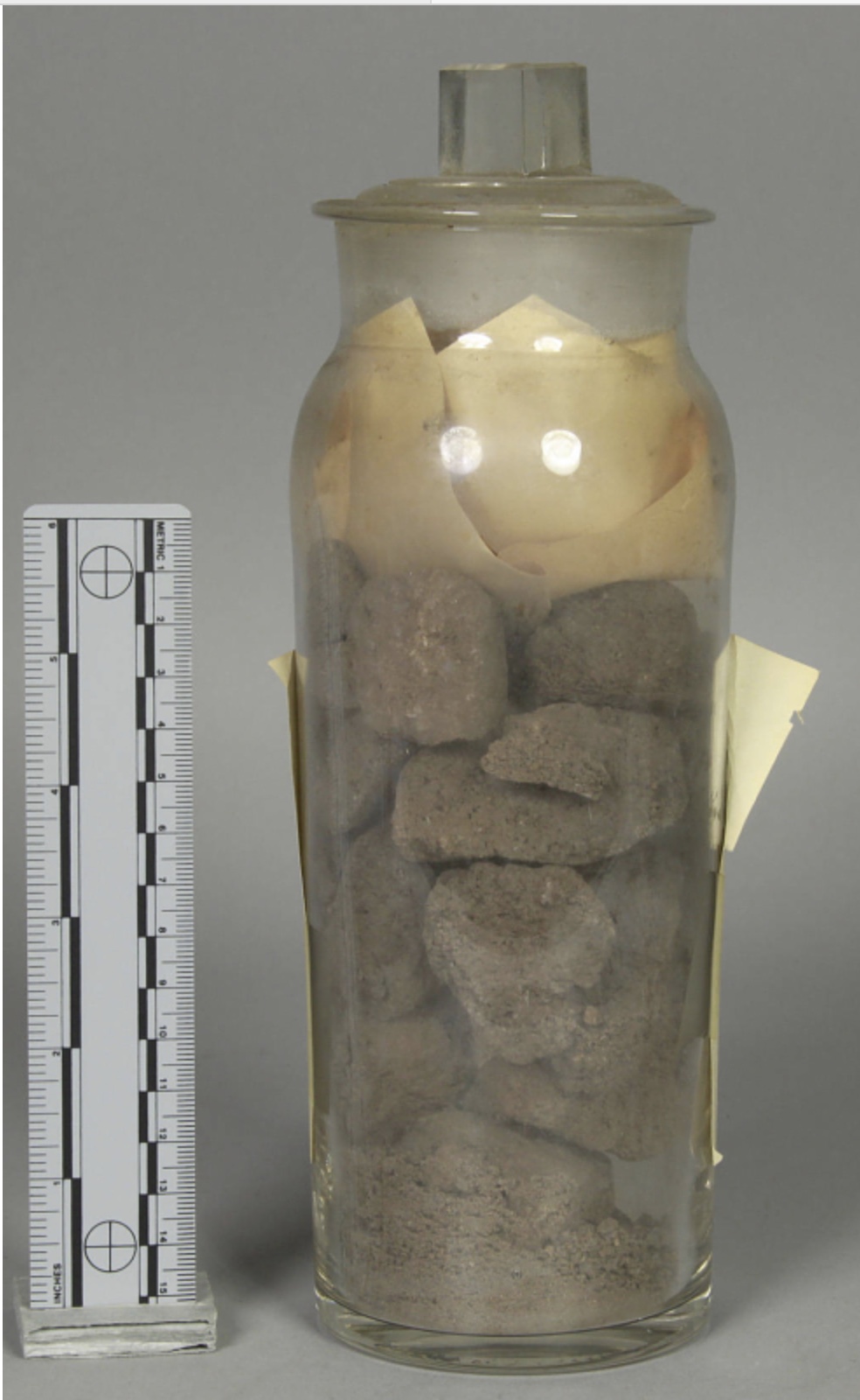
This is salt collected from the Nisenan by Steven Powers in 1876. It's evaporated brine that has been roasted to improve its flavor.
Stored at the Lowie Museum, UC Berkeley.

Probably the oldest and longest used technology in California's Yuba River country was the fire-hardened digging stick – Nisenan women were seldom seen without one.  It was used to get at bulbs roots and tubers known by botanists as geophytes.  Many of these plants, like brodias, produce beautiful flowers.  As the Nisenan and others harvested they loosened and aerated the soil, divided the plants’ underground storage parts and left behind small cormlets, bulblets or fragments in the soil, stimulating regrowth.  As a result, these plants were prolific – white people called them “Indian potatoes” and had no idea that their patterning was deliberate.

The digging stick was also used to reach things on the ground, to reach above, as a lever, as a fire tender, for self-protection, as a walking staff and it had many other functions.  Use of the digging stick was so widespread that miners indiscriminately and disparagingly called the foothill Indians “Diggers”.  Trask’s 1853 map shows a place called Digger Bar on the South Yuba, just upstream from Missouri Bar.  This is intriguing – was it named for Indians or miners? Was it originally a Nisenan fishing camp and then a placer mining site?  It’s supremely ironic that the miners, who incessantly dug at gravel banks and rock ledges, called the native people diggers.

Yankee Jims 1902, North Fork of the American River
Provenance Unknown

Beyond all that, land-based traditional people like the traditional Nisenan realized that that humans are part of the cycle of life and the environment is viable only when humans view the life surrounding them as kin.  Anthropologist and RarĆ”muri Indian, Enrique Salmón describes this as "kincentric ecology" whereby indigenous people are affected by and, in turn, affect the life around them.  These interactions enhance and preserve the ecosystem.  “Without human recognition of their role in the complexities of life in a place, the life suffers and loses its sustainability.”  The kin, or relatives, include all the natural elements of an ecosystem.  Interactions that result from this "kincentric ecology" enhance and preserve the ecosystem.  According to Salmón, “Without human recognition of their role in the complexities of life in a place, the life suffers and loses its sustainability" (Kincentric Ecology: Indigenous Perceptions of the Human-Nature Relationship: 2000).  To live well on the western slope of the Sierra Nevada the Nisenan, their ancestors and neighbors required access to two or three ecosystems. It was essential to recognize patterns and associations that occur in response to climate and are exhibited in plant and animal behavior.  To live fully was to move with the ripening of plants and the migrations of animals. Add to this, opportunities for feasting, trade and socializing and you can begin to see how satisfying and rich the Nisenan way of life was prior to colonization.

Julia Parker, Pomo
Practicing acorn preparation in the Miwok/Paiute tradition

Wednesday, January 23, 2019

BLACK SWAN PRESERVE: WHERE DEER CREEK ENTERS THE YUBA

The Former Black Swan Hydraulic Mine is Now a Wildlife Preserve

On the border between Yuba and Nevada Counties is a former gold mining location where nature is reclaiming what was once a stark industrial site.  The Black Swan Preserve is located in the blue oak–gray pine savannah belt near Smartsville, CA and it’s at a low enough elevation to be accessible all year. Here the Bear Yuba Land Trust maintains a two-mile loop trail circling a pond and wetland where there was once a hydraulic mine.  The trailwas made possible by a partnership between the Bear-Yuba Land Trust and California Fish and Wildlife.  It’s the first trail in what will eventually become a larger network of trails accessing more diverse ecosystems in the area.

The trail circles an intact wetland that is critical habitat for the endangered Western pond turtle, as well as bass, and an array of waterfowl including the American Dipper and Belted Kingfisher.  Known endangered species on the properties include Valley Elderberry Longhorn Beetle, Western Burrowing Owl, and Black Rail.  Adjacent grassland pastures, rolling hills and meadows provide habitat for bears, bald eagles, mountain lions and deer.  Near the confluence of Deer Creek and the Lower Yuba River there is riparian habitat, blue oak woodland, wetlands and groundwater-fed ponds.

Nearby Empire Ranch was an important transportation hub for freighters and stages.  Several major roads and trails met here including the Sacramento Road which ran from Parks Bar, through Sucker Flat and Excelsior, then up Deer Creek to Mooney Flat Road, and from there either to the diggings at French Corral, Sweetland and North San Juan or to Grass Valley and Nevada City via what is now known as the Bitney Springs/Newtown Road. 

Begin by following the clearly marked trail as it passes through a gated fence with a huge moss-covered boulder just beyond it.   Follow the trail as it climbs upslope on a series of gradual switchbacks.  As you climb, you’ll notice a lot of rounded gravel in the bank cuts.  That’s because 60 million years ago this was part of a gold bearing stream system. When this rich mining ground was discovered in 1853 it was mined intensively for the next thirty-one years and then periodically into the Depression era.

Traversing An Ancient Stream Bed

Soon you’ll stop climbing and the trail begins to follow a ditch, which once delivered water to nearby hydraulic mines.  Water, under pressure provided by gravity, was directed by large nozzles at hillsides containing ancient auriferous gravels.  The idea was to saturate and collapse the compacted gold bearing soils into a slurry of mud and gravel.  This muddy mess, known variously as tailings, debris or slickens, was then pushed to the mine’s sluice boxes where riffles, aided by quicksilver (mercury), captured gold particles in a process known as gravity separation.  After sluicing, the debris was pushed by the water cannons, typically called monitors, towards the mine’s drain tunnels and ultimately into the nearest stream course where it continued downstream with no concern for the consequences below.  Those consequences included degraded habitat for fish and riparian flora and fauna, rising water levels that threatened levees and inundation of agricultural lands by mine waste, or debris.

Hydraulic mining requires enormous amounts of water and selling water to miners was a lucrative business.  Most of the original water companies consolidated into a few powerful corporations who eventually bought most of the existing claims from their clients.

Before long, you will be looking down into a huge excavation where you can clearly see the effectiveness of hydraulic mining.  Use caution here and don’t go too close to the edge.  The bottom of the hydraulic pit, which once contained a drain tunnel has become a shallow lake and good habitat for plant and animal life.  From here the trail slowly descends to the lake at the base of spectacular man-made cliffs where I can assure you there will be birds and amphibians.  There is abundant wildlife and there are interpretive signs to enhance understanding of their importance.  Elevations range from 900’ above the hydraulic pit to 760’ at the pond and 600’ on Deer Creek.

The Former  Mine is Rich with Water Fowl

Northeast of the pond, at the one-mile marker, there is an option to continue north on a half-mile spur road/trail to a rugged part of Deer Creek.  This is Department of Fish and Wildlife land, not currently managed by Bear-Yuba Land Trust, so there are no signs.  If you want to get to Deer Creek follow the road north for about a half-mile to a bend in the road where it starts to climb.  Take the road on your right (northeast) for a short distance to a small meadow/knoll from which you can hear the creek.  Walk toward the creek on an unmarked trail that descends to Deer Creek where there is a good view and, with enough water, a waterfall. The creek’s flow is managed by an upstream dam at “Lake” Wildwood.  I recommend hiking the whole three miles and re-visiting it in different seasons.  If you wander, please note that there are parcels of private property on the hilltop with clearly posted “No Trespassing” signs, please respect them.

The indigenous people have lived in this area for thousands of years.  In 1849, when gold was discovered at nearby Rose Bar on the Yuba River, Nisenan people were gathering clover here.  There were important native settlements at nearby Empire Ranch, Sucker Flat, Deer Creek and many other places in the vicinity.  Gold mining and grazing practices have disturbed so much of the surface that most archaeological evidence of the native people is gone.

"Bottle  Brush"

Mooney Flat was first mined for gold in 1850.  A ditch to the Mooney Flat hydraulic mines was completed in 1860 and by 1875 all the smaller operations were absorbed by the Deer Creek Mine.  There is still a small community at Mooney Flat, which is adjacent to Slack’s Ravine, a tributary of Deer Creek, a tributary of the Yuba River.  In the late 19th century the nearby town of Smartsville and the former towns of Timbuctoo and Sucker Flat, all located on the west side of the hill, were adjacent to some of the most productive hydraulic mines in the state.  Among them was the Blue Point Mine, which by 1877 produced $13,000 million.  As hydraulic mines prospered gravel and mud produced by their activities began covering agricultural land downstream in the Sacramento Valley.  After numerous attempts at litigation, infuriated farmers finally stopped the practice of dumping “debris” into streams by the restraints of the Sawyer Decision in 1884.  This injunction essentially ended large-scale hydraulic mining.  As a result, major investors pulled out while experienced mine managers and engineers left the region.  In 1893 the Caminetti Act allowed the resumption of hydraulic mining if the gravel and mud could be restrained by dams.  This was an impossible task – the dams created by mining companies in this district were repeatedly cited for infractions and eventually shut down.


An 1870s Map From a Government Publication Showing Timbuctoo Bend and Deer Creek

The State Mineralogist Report for 1893 describes the operations of the Mooney Flat Drift Gravel Mine where they sunk a 200’-300’ foot shaft while employing nine men.  They were milling the gravel with arrastras, a 19th century technique introduced by the Spanish.  Arrastras utilize draft animals and drag stones, a primitive method, but capable of milling the ore finer than other processes.

By 1904 the Black Swan Company owned the former Deer Creek Mine.  Within a four-month period they recovered $100,000 by sinking shafts and tunneling beneath the 40-foot deep lake which eventually caved-in on the workings beneath the lake.  According to the Grass Valley Union, “The fourteen men working underground raced for the surface and life.”  No one was hurt but the last man out saw his hat blown ahead of him by the blast of air from the cave-in.

"Black Swan" was an expression used to describe an unexpected event with bad consequences, which although unforeseen, appears inevitable with the benefit of hindsight.  In 16th century London, Black Swan was commonly used as a statement of impossibility because the presumption was that all swans were white.  When Dutch explorer Willem de Vlamingh discovered black swans in Australia in 1697 the term’s meaning changed to the awareness that a perceived impossibility might later be disproven.


A Gnarly Oak at the Edge of the Hydraulic Excavation

In 1905 the Registry of Mines and Minerals noted that the mining ground “… was claimed by the Excelsior Company and leased to Black Swan who were drifting into the gravel banks.”  The Mining & Scientific Press of March 7, 1909 reported, “A controlling interest in the Black Swan mine has been secured by J.A. Sowell, a Yuba County business and mine operator.  On August 7, 1909 they reported that, “The Black Swan mine at Mooney Flat is to be reopened.  A 150’ shaft was sunk on the property several years ago, but the pumps were drowned out and the company stopped work.  The machinery is being overhauled and a larger pumping plant will be installed.  A good body of gravel was cut by the shafts and short drifts run along the bedrock.”  

Ditch Near the Black Swan Drain Tunnel on Deer Creek

Drift mining is a process that uses tunnels and shafts to get at gold accumulated on the bedrock of the Tertiary channels (ancient rivers).  It became popular after the Sawyer Decision, but the work was more difficult and the yield was less.  During the Depression over a thousand placer miners worked the bars and benches along the Yuba between Deer Creek and Parks Bar using simple processes that were used during the gold rush.

Between 1933 and 1935 the value of gold rose dramatically but it cost more to mine it.  James B. Moffatt tried to reopen the Black Swan in 1938 but “when misfortune overtook his grubstaker” he was forced to suspend operations.  On August 25, 1938 The Union reported that the Black Swan shut down due to “Lack of funds.”

Logan’s 1940 Map of the Western Portion of Nevada County, CA Showing Mining Claims shows the 270-acre Deer Creek Placer Mine but in 1942 Executive Order L-208 shut down most of the gold mines in the country.  In the same year Camp Beale, an Army Base at the time, exercised eminent domain and appropriated the Excelsior Ditch system.  The holdings were returned to private ownership in the 1950s, but after skirmishes in court, Nevada Irrigation District had lost its rights-of-ways.


Larry, Birding


How to get there:
The trailhead is located off of Mooney Flat road just east of Smartsville, CA.  From the intersection of Hwy 49 and Hwy 20 near Grass Valley, drive 13 miles toward Smartsville, turn right (North) on Mooney Flat Road.  If you see the Yuba County sign on Highway 20, you have gone too far.  Once you are on Mooney Flat Road, drive approximately ¼ mile and turn left into small signed parking area.

If you are coming from the Yuba City/ Marysville area, head east on Highway 20 and cross the Yuba River.  Immediately after passing Smartsville, turn left onto Mooney Flat road. 

Note: Gates keep cattle in and vehicles out – please keep them closed.  Keep dogs leashed and mind your children.  No smoking, littering or motorized vehicles allowed.  Please stay on the trails.  Poison oak thrives all year while ticks and rattlesnakes are active in the warmer months.

Friday, December 28, 2018

THE SPENCEVILLE WILDLIFE AREA: ROLLING HILLS UNDER A BIG SKY


 The Spenceville Wildlife and Recreation Area (SWA) is the largest publicly owned tract of blue oak - gray pine woodland habitat in the North Central Sierra foothills.  It contains 11,942 acres, extending 10 miles from north to south and up to 4.5 miles east to west. Straddling the western boundary of Nevada County and the eastern boundary of Yuba County, the wildlife area is bordered on the west by Beale Air Force Base and on the north, south, and east by privately owned ranches and parcels.  The SWA is managed by the Department of Fish and Wildlife (formerly known as the Department of Fish and Game) and is located within the Dry Creek drainage, which joins the Bear River near Wheatland. There are numerous ponds, creeks, trails and riparian zones in the area.  Parts of Vineyard Creek, and most of Cox and Little Dry Creeks flow south through the area boundaries to join Dry Creek, a perennial stream.

THE ECOSYSTEM
The primary habitat is open savannah rising eastward to open woodlands with shrubby understories.  Lower elevation woodlands merge with annual grasslands.  Blue oak and gray pine are the characteristic species with sporadic valley oak and interior live oak.  Near the water courses and ponds there are willow, alder, cattails and other riparian species.

Blue Oak

Blue oak is California’s dominant oak species, representing more than one-third of the state’s oak woodlands. Blue oaks are adapted to drought and dry climates and they can survive temperatures above 100° F for several weeks at a time.  Average maximum temperatures in July can range from 70° to 100° F while annual precipitation averages 20 to 40 inches and mostly falls in the form of rain.

Blue oak acorns are long, thin, and gently tapering.  They are 3/4 to 1 1/2 inches long with shallow caps.  The acorns ripen in one year, and can germinate after one month, unlike other oak varieties, which germinate the following spring.  From the beginning most of the growth is in the roots instead of the shoots.  This allows it to tap into available water sources right away to survive dry conditions. It’s an important food source for deer, rodents, game birds and at least a dozen species of songbirds.  They are slow growers, and deceptively small plants can be 25 years old.  Blue oaks can live 200 to 500 years, but the blue oak population has decreased because there has been little natural regeneration.  According to Department of Fish and Wildlife (DFW) employees, grazing cattle and feral pigs eat many of the acorns and seedlings.

On the west slopes of the Sierra Nevada, blue oak is abundant in the foothills at an elevational range of 500 to 2,000 feet.  The most common tree associate of blue oak is gray pine however blue oak extends farther into valleys but not as far into montane regions as the pine.  Blue oak is usually the majority species, grey pine inevitably the taller.  Most sound acorns fall between mid-September and the end of October.  They average 100 seeds per pound and yield from 55 to 180 pounds. 

Acorn woodpeckers are very busy birds

Recently conducted wildlife surveys of SWA found 42 mammal species, 12 kinds of reptiles, 4 kinds of amphibians, and 20 fish species.  The Audubon Society considers Spenceville a birding “hot spot”, listing 80 nesting, and 175 migratory bird species.

CULTURAL CONTACT
There is no clear evidence that Spanish or Mexican land uses had any significant impact on the distribution or abundance of oak woodlands.  The introduction of livestock led to dramatic changes in understory species, which may have had some effect on oak regeneration, but this first wave of settlement left California’s oak woodlands largely intact.

Major changes began during the American period, with the huge population influx that accompanied the Gold Rush.  Within two decades, riparian oak woodlands were nearly completely destroyed.  Oaks were cleared for agriculture, fuel wood, charcoal, rangeland improvements, and urbanization. Recent urbanization has expanded into oak woodlands, fragmenting wildland habitat.

After 1940 agricultural land clearing was encouraged through federally funded programs. Examples include the War Food Program started in 1941, and the Agricultural Adjustment Administration range improvement program intended for the Eradication and Control of Destructive and Competitive Plants.  It was assumed that removal of blue oak would improve forage production, so inexpensive methods were devised for killing and removing oaks.  These methods included poisoning with herbicides such as 2,4-D and 2,4,5-T and burning and bulldozing.  I don’t know if any of these programs were implemented in the Spenceville area.  Another impact has been predator extermination, which has caused an increase in acorn and nut eating animals including gophers, mice, ground squirrels, rabbits, deer and cattle. Acorns and seedlings are being eaten out existence.

Winter is beautiful at Spenceville

In 2002 the U. S. Forest Service published research findings in Oaks 2040: The Status and Future of Oaks in California.  They estimate that of the 3 million acres of blue oaks in California 750,000 acres, or 25 percent of California oak woodlands, will be seriously threatened from a burgeoning state population by 2040.  Many species of oaks are under threat of extinction in the wild, largely due to land-use changes, livestock grazing and unsustainable harvesting.  

The Sacramento region, which includes the Yuba and Bear Rivers, is more at risk for development than any other.  Only two-thirds of the oak woodlands are considered “stable.”  More than 300,000 acres of oak woodland could be developed in the Sacramento region by 2040.  By 2040, 80 percent of El Dorado County’s oak woodlands and more than half of the oak woodlands in Nevada, Yuba, and Placer Counties may be developed.  They conclude that California should plan for protection of its stable oak ecosystems now,  before these ecosystems are fragmented beyond repair.  We are indeed very fortunate to have access to the Spenceville Wildlife Area – it has become an endangered ecosystem.  Meanwhile, in 2004, congress passed legislation designating the oak as America’s national tree.

THE NATIVE NISENAN PEOPLE 
The Spenceville area has a rich history that begins thousands of years before the Spanish, Mexicans and European gold seekers arrived.  Bedrock mortars for pounding acorns and other foods are plentiful especially near springs and streams and they are a visible legacy of the Nisenan people who have lived here for at least 1,500 years.  By the time of European contact, acorns and pine nuts were a major part of the Nisenan diet.  They manipulated the environment by frequently burning the landscape to improve the gathering of acorns, to facilitate collection of grass seeds, to stimulate growth of shoots used for basketry, to clear brush for hunting and to create nutritious browse for deer.  These deliberate fires helped maintain open oak savannas where succession would have led to coniferous forest.

The Nisenan interacted with the largest oaks and sustained an intimate relationship with them for centuries.  They were aware that they provided sustenance, shade and continuity for generations.  Ancient oaks were living monuments that witnessed the history of the indigenous people unfold.  Generations of Nisenan met in the shade and splendor of special oak trees.  To the colonizers, these gigantic oaks were viewed simply as trees without any inherent wisdom.  With the commoditization of oak trees, not only did their importance as food decrease, but their spiritual significance to the Nisenan diminished. 

Bedrock mortars on Dry Creek

Naturally, such reckless damage to the flourishing ecosystem that was their homeland was resented by the Nisenan.  The invaders ridiculed the natives, stole from them, abused the women and could be extremely violent.  When the Nisenan resisted, the foreigners formed militias and declared war on the natives – their paranoia and hatred was so intense that they petitioned for, and received, a small military garrison called Camp Far West, located a few miles southwest of SWA.

In 1850 the Camp Union Treaty was negotiated with the Nisenan, who by now realized that they were hopelessly outnumbered.  This was one of 18 treaties made with California Indians – not one of these treaties was ever ratified (but this is a story for another time).  The proposed reservation for the Nisenan included the current SWA.

A diseƱo, or map, of John Rose's Mexican Land Grant

In addition to the notorious impacts of gold mining there was grazing.  Before the gold rush John Rose was awarded a Mexican Land Grant known as “Rancho de Yubu” which was approximately 16 square miles and included parts of the SWA.  Rose became rich by providing the expanding mining population with cattle and horses fed on grasslands that once belonged to the Nisenan.

Agriculture was not sophisticated, nor was the palate of the average miner, but one endeavor requires special mention.  Scurvy was a problem because of a lack of Vitamin C.  A few innovative black men filled a need when, in 1852, they planted and sold cabbages, which stored well and provided vitamin C for would-be miners packing into the mountains.  The community of Cabbage Patch was just south of Dry Creek and along the busy road from Sacramento to Empire Ranch, a major transportation hub.  It was near the present-day Waldo Bridge and within the SWA. In 1898, when there was enough of a community to warrant a Post Office, Cabbage Patch was renamed Waldo, after Captain William Waldo, who in 1850 led a successful rescue party to the Humboldt Sink in Nevada.  

Cattlemen moving their cows

The Waldo schoolhouse was at the intersection of the Spenceville Road and Long Ravine Road and the current Waldo Bridge on Dry Creek was built in 1901.  Apparently, the bridge was rebuilt several times and almost destroyed by vandalism in 1964.  Now I don’t want to imply that this is a bad neighborhood but only last week my truck was broken into and robbed while parked alongside the road less than a mile from here.  Employees of SWA told me it’s happened before – so when you visit this otherwise beautiful place make sure that you don’t leave anything of value in sight.

Spenceville was named for Edward F. Spence, a Nevada City druggist, who in 1868 donated lumber to build the local school house.  Spence was a member of the Nevada City Board of Trustees in 1865 and later organized banks in several California cities.  He eventually served a term as Mayor of Los Angeles where he was instrumental in establishing the Mt. Wilson observatory.

Tailings in Albion Ravine

There is evidence of early gold mining in Albion Ravine and there was a copper boom along Little Dry Creek in the 1860s.  The most famous of the copper mines was adjacent to the town of Spenceville.  By 1879 the town of Spenceville had a Post Office, a school, three general stores and was home to 67 families.  In 1915 the mine’s surface structures burned to the ground.  Some of the families stayed and operated ranches

SPENCEVILLE MINE HISTORY
The mine was originally discovered by some men digging a well in 1862 who named it the Well Lead Copper mine.  In the 1870s the Well Lead and the adjoining Grass Valley Copper Mine were bought by the San Francisco Mining Company and $15,000 was invested on improvements to the site.  The combined mines were then renamed the San Francisco Copper Mine and Reduction Works. In 1880 their headframe collapsed into the shaft.  No one was injured but high expenses were incurred.  As a result, management abandoned shafts and decided on an open cut that measured 300’ long by 70’ wide by 75’ deep.  In 1882 they owned 43 acres of copper-bearing ground and 100 acres of adjoining land was bought for timber and fuel wood.  They were heap roasting ore that was hand-broken by Chinese workmen into small lumps before being hoisted to the surface where they were heap roasted.  The imperfectly roasted ore was then returned to a fresh roast-heap, and the rest trammed to the leach vats.  They employed 23 white men and 40 Chinese at the mine and the mill and several “wood choppers.”

With copper values in flux the San Francisco Copper Mine and Reduction Works sold their property to the Imperial Paint Company and Copper Works. The new owners didn’t really mine but instead reworked tailings containing iron oxides to produce a Venetian red paint pigment.  This paint became all the rage – it even won a Gold Medal in the San Francisco 1894 Winter Exposition.  But, by 1897 the business failed when it was discovered that the paint corroded the structural nails causing barns and other buildings to collapse.  Then the mine was renamed the Spenceville Mineral Company and in 1915 was damaged by a fire with mining completely shut down in 1918.

This is not the end of the story.  When I started visiting SWA in the late 70s the mining site was easily accessible with a pit containing deep blue water of a scary hue, nearby Little Dry Creek had strange chemical crusts on its banks, there was little vegetation and the soil was reddish, arid and dusty.  Not at all hospitable, not even natural.  Here’s the State Department of Conservation’s initial assessment of the situation: “The 10-acre site included 60,000 cubic yards of mine waste and a half-acre, water-filled mine pit.  The pit contained 7.5 million gallons of pH 2.5 acid mine drainage – essentially, battery acid that was trickling into two creeks.  The flooded pit posed a risk not only to wildlife, but also to people recreating in the area.”

In 1988 the Department of Fish and Wildlife started exploring the possibility of cleaning up the site, however funding to actually complete the project didn’t become available until 2000.  Actual work began in 2001 and was declared a success in 2013.  The former mine is currently fenced off while the replanted vegetation takes hold.  The pit has been drained and backfilled, the tailings removed, soil has been buffered by lime to remove its acidity and Little Dry Creek is replanted.  The Department of Conservation is pleased with the results and was honored with a Governor’s Environmental and Economic Leadership Award in 2013.

View from a bunker created when Beale owned this land

BEALE AIR FORCE BASE
In 1942 the U.S. Army acquired (often by eminent domain) 86,000 acres of oak-woodland and prairie grassland, including Spenceville, for training purposes.  There are still concrete bunkers from this era dotting the landscape within the SWA. By 1964 the government sold all but 22,944 acres, which it retained as Beale Air Force base.

SPENCEVILLE WILDLIFE AREA
The Department of Fish and Game acquired land from the federal government to create the Spenceville Wildlife Area in 1966.  Humans frequent the area as well.  There is a varied group of users that includes hikers, bicyclists, equestrians, bird watchers, fisherman, hunters and cattle ranchers who have grazing allotments here. They even offer a shooting range.

Map of the Spenceville area
Courtesy of Friends of Spenceville

TRAILS
Spenceville contains several very scenic trails that require little effort.  For instance, North Pittman Road is one of several closed roads with numerous equestrian trails that branch off revealing oak groves, open meadows and wildlife ponds.  To reach the road walk across the concrete bridge at the Spenceville parking lot and turn left.

The most popular hike is the well-marked 2.5-mile trail to Fairy Falls.  On a spring or summer weekend it can be extremely popular.  From the parking area walk across the concrete bridges over Dry Creek and Little Dry Creek and continue northeastwardly on the historic Spenceville Road as it gradually climbs.  The meadow on the north side of the road was the location of the town of Spenceville.  All that remains are some rock alignments, olive trees and a small concrete structure that was a well.  This segment of road/trail is about one mile long with an elevation gain of only 200 feet.

Fairy Falls on Dry Creek

When you come to the southern end of a beautiful valley the clearly marked trail leaves the road and extends southward.  In the 1860s this was the location of Zinc House, a way station where travelers could get food and water for themselves and their animals.  Soon the trail splits into an upper and lower trail to the falls.  The upper trail travels mid-slope though a savannah-like landscape of blue oak, grasses and wildflowers (in season) with a good overview of the Dry Creek canyon.  The lower trail is adjacent to the creek where there is different vegetation and access to water.  Early one April morning, while hiking the lower trail, I startled three deer and saw a display of hundreds of dewy fairy lanterns and yellow pretty faces illuminated by the rising sun.  For the full experience take the upper trail to the falls and return by the lower trail.

Luscious lichen at Fairy Falls

You'll be glad you made the effort.  At Fairy Falls, Dry Creek drops 40 feet before crashing into a dramatic bowl-shaped pool with steep walls surrounding it.  Below this pool is another, slightly smaller waterfall.  The view from the top of the falls is terrific.

SAFETY
Hiking is great all year at Spenceville, especially if you are prepared. Summers are very hot so bring enough water and protection from the sun and heat.  Poison oak thrives here but can be avoided by staying on roads and trails.  Learn to identify it.  Ticks are especially active in the spring and early summer.  In the winter Spenceville can be foggy creating a moody and mystic landscape that is damp and sometimes cold.  If you are coming to Spenceville from upslope you may be surprised to find yourself in valley fog, which is no problem if you remembered to bring appropriate clothing.


Remnants of the original Kneebone Ranch

HOW TO GET THERE: 
From Grass Valley, drive 12.5 miles west on Highway 20 toward Marysville.  Turn south (left) from Highway 20, at the Beale Air Force Base sign, onto the Smartsville-Hammonton Road.  After .9 mile, take the left fork on Chuck Yeager Road and continue for 3.8 miles to Waldo Road.  Continue along Waldo Road for 1.8 miles to the Waldo Bridge.  After crossing the bridge, continue to the left along Spenceville Road for 2.3 miles until you arrive at a parking area and trailhead by the old concrete bridge and abandoned mine site.

For maps and more specific information:

      Spring is gorgeous here